Pender, Nebraska
| Pender, Nebraska | |
|---|---|
| Village | |

Downtown Pender: north side of Main Street
|
|
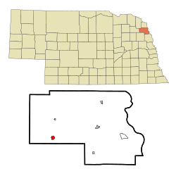
 Location of Pender, Nebraska |
|
| Coordinates: 42°6′42″N 96°42′38″W / 42.11167°N 96.71056°WCoordinates: 42°6′42″N 96°42′38″W / 42.11167°N 96.71056°W | |
| Country | United States |
| State | Nebraska |
| County | Thurston |
| Area | |
| • Total | 0.71 sq mi (1.84 km2) |
| • Land | 0.71 sq mi (1.84 km2) |
| • Water | 0 sq mi (0 km2) |
| Elevation | 1,342 ft (409 m) |
| Population (2010) | |
| • Total | 1,002 |
| • Estimate (2012) | 1,012 |
| • Density | 1,411.3/sq mi (544.9/km2) |
| Time zone | Central (CST) (UTC-6) |
| • Summer (DST) | CDT (UTC-5) |
| ZIP code | 68047 |
| Area code(s) | 402 |
| FIPS code | 31-38750 |
| GNIS feature ID | 0832034 |
Pender is a village in Thurston County, Nebraska, United States. On March 22, 2016, the United States Supreme Court resolved a disagreement as to whether Pender is located on the Omaha Indian Reservation, holding unanimously that "the disputed land is within the reservation’s boundaries." The predominantly European-American population was 1,002 at the 2010 census. The village supports seven liquor stores.
The village is the county seat of Thurston County. European-American settlers founded the village in April 1885, naming it in honor of the Scottish politician and businessman Sir John Pender, a pioneer of the Transatlantic Cable. He founded what is now Cable & Wireless Worldwide, and was a director of the Chicago, St. Paul, Minneapolis & Omaha Railway.
Pender is located at 42°6′42″N 96°42′38″W / 42.11167°N 96.71056°W (42.111563, -96.710612).
According to the United States Census Bureau, the village has a total area of 0.71 square miles (1.84 km2), all of it land.
Tribal authorities of the federally recognized Omaha Nation assert that Pender is within the boundaries of the reservation as defined in its 1865 treaty with the United States. However, a Nebraska state court held in 1999 that the western boundary was a railroad right-of-way east of Pender, because of Omaha land sales to white farmers over the decades. The tribe's response is that the state does not have the power to redefine the boundary set by the Omaha treaty with the US government in 1865.
...
Wikipedia
