Peach County, Georgia
| Peach County, Georgia | |
|---|---|

Peach County Courthouse in Fort Valley
|
|
 Location in the U.S. state of Georgia |
|
 Georgia's location in the U.S. |
|
| Founded | July 8, 1924 |
| Named for | Peach fruit |
| Seat | Fort Valley |
| Largest city | Fort Valley |
| Area | |
| • Total | 151 sq mi (391 km2) |
| • Land | 150 sq mi (388 km2) |
| • Water | 1.0 sq mi (3 km2), 0.7% |
| Population | |
| • (2010) | 27,695 |
| • Density | 184/sq mi (71/km²) |
| Congressional district | 2nd |
| Time zone | Eastern: UTC-5/-4 |
| Website | www |
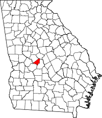
Peach County is a county located in the central portion of the U.S. state of Georgia. As of the 2010 census, the population was 27,695. Its county seat is Fort Valley. Founded in 1924, it is the state's newest county, taken from Houston and Macon counties on July 8 of that year. Its namesake is the peach, Georgia's most famous crop.
Peach County is included in the Warner Robins, GA Metropolitan Statistical Area, which is included in the Macon-Warner Robins, GA Combined Statistical Area.
According to the U.S. Census Bureau, the county has a total area of 151 square miles (390 km2), of which 150 square miles (390 km2) is land and 1.0 square mile (2.6 km2) (0.7%) is water. It is the fifth-smallest county in Georgia by area.
The majority of Peach County is located in the Lower Ocmulgee River sub-basin of the Altamaha River basin. A small portion of the northern edge of the county, north of Byron, is located in the Upper Ocmulgee River sub-basin of the Altamaha River basin. The very western tip of Peach County is located in the Upper Flint River sub-basin of the ACF River Basin (Apalachicola-Chattahoochee-Flint River Basin).
...
Wikipedia
