Paso de los Libres, Corrientes
| Paso de los Libres | |
|---|---|
| City | |

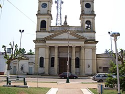
San José Church, Paso de los Libres
|
|
| Coordinates: 29°43′S 57°5′W / 29.717°S 57.083°WCoordinates: 29°43′S 57°5′W / 29.717°S 57.083°W | |
| Country |
|
| Province |
|
| Department | Paso de los Libres |
| Government | |
| • Mayor | Eduardo A. Vischi (Unión Cívica Radical) |
| Population (2010 census) | |
| • Total | 43,251 |
| Demonym(s) | libreño/a |
| Time zone | ART (UTC-3) |
| CPA base | W3320 |
| Dialing code | +54 3772 |
Paso de los Libres is a city in the east of the province of Corrientes in the Argentine Mesopotamia. It had about 44,000 inhabitants at the 2001 census [INDEC], and is the head town of the department of the same name.
The city lies on the right-hand (western) shore of the Uruguay River, opposite the city of Uruguaiana, Rio Grande do Sul, Brazil, to which it is joined by a road and railway bridge (Paso de los Libres-Uruguaiana International Bridge). The area is served by Paso de los Libres Airport.
...
Wikipedia

