Pantnagar Airport
| Pantnagar Airport | |||||||||||
|---|---|---|---|---|---|---|---|---|---|---|---|
| Summary | |||||||||||
| Airport type | Public | ||||||||||
| Operator | Airports Authority of India | ||||||||||
| Location | Pantnagar | ||||||||||
| Elevation AMSL | 233 m / 764 ft | ||||||||||
| Coordinates | 29°01′56″N 079°28′27″E / 29.03222°N 79.47417°E | ||||||||||
| Map | |||||||||||
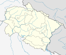
| Location of airport in India | |||||||||||
| Runways | |||||||||||
|
|||||||||||
Pantnagar Airport (IATA: PGH, ICAO: VIPT) is a domestic airport located in Pantnagar of Udham Singh Nagar district in the Indian state of Uttarakhand. It is operated by the Airports Authority of India. It is the nearest airport to the Kumaon hill stations of Nainital (65 km), Bhimtal (50 km), Ranikhet (110 km) and Almora (120 km) and the Jim Corbett National Park (120 km).
The airport was able to accommodate only small aircraft until 2008, when the length of the runway was increased to 4,500 feet to accommodate larger turboprop aircraft at a cost of ₹75 crores.
The Government of Uttarakhand had offered a subsidy to Jagson Airlines between 2005 and 2008, to undertake daily scheduled flights between Pantnagar and Indira Gandhi International Airport, Delhi. The annual subsidy was not renewed in 2008 when the runway length was increased. The government then invited Deccan Aviation to fly on the Delhi - Pantnagar route.Kingfisher Airlines, which took over Deccan Aviation, undertook seasonal flights to Pantnagar as poor weather did not allow it to fly around the year. The airport had been without a commercial service ever since Kingfisher ceased operations. Pantnagar Airport, now, has daily Air India Regional flights to and from IGI, Delhi (since 01 Oct 2014).
...
Wikipedia

