Panagarh Airport
| Panagarh Airport | |||||||||||
|---|---|---|---|---|---|---|---|---|---|---|---|
| Summary | |||||||||||
| Airport type | Public | ||||||||||
| Operator | Government | ||||||||||
| Location | Panagarh, India | ||||||||||
| Elevation AMSL | 240 ft / 73 m | ||||||||||
| Coordinates | 23°28′28″N 087°25′39″E / 23.47444°N 87.42750°E | ||||||||||
| Map | |||||||||||
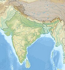
| Location of Panagarh Airport in India | |||||||||||
| Runways | |||||||||||
|
|||||||||||
|
Source: DAFIF
|
|||||||||||
Panagarh Airport (ICAO: VEPH) is an airport serving Panagarh, in the state of West Bengal in India. It also serves as an Indian Air Force base.
During World War II, the airport was used as a supply transport airfield from 1942-1945 by the United States Army Air Forces Tenth Air Force and as a repair and maintenance depot for B-24 Liberator heavy bombers by Air Technical Service Command.
The airport has numerous wartime relics, with abandoned taxiways and a large concrete parking ramp remaining, although not used and in a deteriorating state.
The airport resides at an elevation of 240 feet (73 m) above mean sea level. It has one runway designated 15/33 with an asphalt surface measuring 2,743 by 46 metres (8,999 ft × 151 ft). The Air Force is planning to deploy six mid-air refuelling tanker aircraft at Panagarh air base in West Bengal. With the deployment of these tanker aircraft in Panagarh, the striking range of fighter planes like Su-30 MKIs based in Tezpur and Chabua (both in Assam) will be enhanced as these can get fuel mid-air.Panagarh is also the likely location of a proposed Army Mountain Corps headquarter.
...
Wikipedia

