Palms, California
| Palms | |
|---|---|
| Neighborhood of Los Angeles | |

A typical Palms apartment-district street
|
|
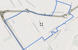
 Palms boundaries as shown on "Mapping L.A." project of the Los Angeles Times |
|
| Location within Western Los Angeles | |
| Coordinates: 34°01′23″N 118°24′18″W / 34.023°N 118.405°WCoordinates: 34°01′23″N 118°24′18″W / 34.023°N 118.405°W | |
| Country | United States |
| State | California |
| County | County of Los Angeles |
| City | City of Los Angeles |
| Government | |
| • City Council | Paul Koretz |
| • State Assembly | Sebastian Ridley-Thomas (D) |
| • State Senate | Holly Mitchell (D) |
| • U.S. House | Karen Bass (D) |
| Area | |
| • Total | 1.9 sq mi (5 km2) |
| Population (2000) | |
| • Total | 42,545 |
| • Density | 21,983/sq mi (8,488/km2) |
| ZIP Code | 90034, 90232 |
| Area code(s) | 310 |
Palms (originally "The Palms") is a highly diverse, densely populated community in the Westside region of Los Angeles, California, founded in 1886 and the oldest neighborhood annexed to the city, in 1915. The 1886 tract was marketed as an agricultural and vacation community. Today it is a primarily residential area, with a large number of apartment buildings, ribbons of commercial zoning and a single-family residential area in its northwest corner.
In Spanish and Mexican days, the area that later became Palms was a part of the Rancho La Ballona, where in 1819 Agustín and Ygnacio Machado, along with Felipe Talamantes and his son, Tomás, acquired grazing rights to 14,000 acres (57 km2) of land. It was thenceforth used as grazing land for cattle and sheep. According to Culver City History, a 2001 work by Julie Lugo Cerra, published for the Culver City Unified School District:
Agustin Machado died in 1865, the same year La Ballona School was constructed to serve all elementary-age children within the Ballona School District. In 1871, Ygnacio Saenz established a general store at the crossing which later became Washington Boulevard and Overland Avenue. (Three corners of that intersection are in Culver City and one is in Palms.) The store, which was also a way stop on the county road between Los Angeles and the ocean, also housed the area's first post office.
By 1882, the county's electoral district serving Palms was known as Ballona, with voting at La Ballona School.
Deke Keasbey, real estate investment specialist for Tierra Properties, has noted that:
La Ballona Valley was part of that land rush. In 1882, several Midwestern families chartered a reconditioned freight car and left their homes in Le Mars, Iowa, to settle in the valley. They held their first Sunday school in the old La Ballona School on Washington Boulevard, and in fall 1883 they organized a United Brethren Church with 11 members.
...
Wikipedia

