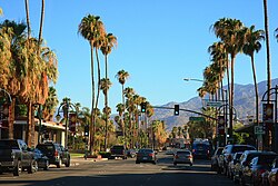
Palm Springs, California
| Palm Springs, California | |
|---|---|
| Charter city | |
| City of Palm Springs | |

Downtown Palm Springs
|
|
 Location in Riverside County, California |
|
| Coordinates: 33°49′49″N 116°32′43″W / 33.83028°N 116.54528°WCoordinates: 33°49′49″N 116°32′43″W / 33.83028°N 116.54528°W | |
| Country |
|
| State |
|
| County |
|
| Incorporated | April 20, 1938 |
| Government | |
| • Mayor | Robert Moon |
| Area | |
| • Total | 94.975 sq mi (245.984 km2) |
| • Land | 94.116 sq mi (243.761 km2) |
| • Water | 0.859 sq mi (2.224 km2) 0.90% |
| Elevation | 479 ft (146 m) |
| Population (April 1, 2010) | |
| • Total | 44,552 |
| • Estimate (2013) | 46,281 |
| • Density | 470/sq mi (180/km2) |
| Time zone | Pacific (UTC−8) |
| • Summer (DST) | PDT (UTC−7) |
| ZIP codes | 92262–92264 |
| Area codes | 442/760 |
| FIPS code | 06-55254 |
| GNIS feature IDs | 1652768, 2411357 |
| Website | palmsprings-ca |
Palm Springs is a desert resort city in Riverside County, California, United States, within the Coachella Valley. It is located approximately 55 mi (89 km) east of San Bernardino, 107 mi (172 km) east of Los Angeles, 123 mi (198 km) northeast of San Diego, and 268 mi (431 km) west of Phoenix, Arizona. The population was 44,552 as of the 2010 census. Palm Springs covers approximately 94 square miles (240 km2), making it the largest city in the county by land area.
Biking, golf, hiking, horseback riding, swimming, and tennis in the nearby desert and mountain areas are major forms of recreation in Palm Springs. The city is also famous for its mid-century modern architecture and design elements.
Archaeological research has shown that the Cahuilla people have lived in the area for the past 350–500 years. The Cahuilla name for the area was "Se-Khi" (boiling water). When the Agua Caliente Reservation was established by the United States government in 1896, the reservation land was composed of alternating sections (640 acres) of land laid out across the desert in a checkerboard pattern. The alternating non-reservation sections were granted to the Southern Pacific Railroad as an incentive to bring rail lines through the open desert.
Presently the Agua Caliente Band of Cahuilla Indians is composed of several smaller bands who live in the modern day Coachella Valley and San Gorgonio Pass areas. The Agua Caliente Reservation occupies 32,000 acres (13,000 ha), of which 6,700 acres (2,700 ha) lie within the city limits, making the Agua Caliente band the city's largest landowner. (Tribal enrollment is currently estimated at between 296 and 365 people.)
...
Wikipedia
