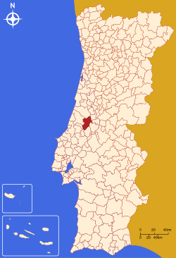
Ourém
| Ourém | |||
|---|---|---|---|
| Municipality | |||
|
|||
 |
|||
| Coordinates: 39°39′N 8°34′W / 39.650°N 8.567°WCoordinates: 39°39′N 8°34′W / 39.650°N 8.567°W | |||
| Country |
|
||
| Region | Centro | ||
| Subregion | Médio Tejo | ||
| Intermunic. comm. | Médio Tejo | ||
| District | Santarém | ||
| Parishes | 13 | ||
| Government | |||
| • President | Paulo Fonseca (PS) | ||
| Area | |||
| • Total | 416.68 km2 (160.88 sq mi) | ||
| Population (2011) | |||
| • Total | 45,932 | ||
| • Density | 110/km2 (290/sq mi) | ||
| Time zone | WET/WEST (UTC+0/+1) | ||
| Website | http://www.ourem.pt | ||
Ourém (Portuguese pronunciation: [owˈɾɐ̃j]) is a municipality in the district of Santarém in Portugal. The population in 2011 was 45,932, in an area of 416.68 km². The municipality of Ourém contains two cities: Ourém (about 12,000 residents) and Fátima (about 11,000 inhabitants).
The municipality is bordered by the municipalities of Pombal (to the north), Alvaiázere (to the northeast), Ferreira do Zêzere and Tomar (to the east), Torres Novas (to the southeast), Alcanena (to the southwest), and Batalha and Leiria (to the west). The main historical attraction of the municipality is the mighty Castle of Ourém. Nevertheless, millions of faithful Catholics come to the parish of Fátima every year to visit Cova da Iria, the site where three child shepherds are said to have had visions of Our Lady of Fátima in 1917. The Sanctuary of Our Lady of Fátima become one of the largest religious tourism sites in the world.
The present Mayor is Paulo Fonseca, elected by the Socialist Party.
The municipal holiday is June 20.
A fortification existed in the region of Ourém since at least the period of Muslim domination. The area was reconquered by Christians in 1136, and the town was donated in 1178 by the first king of Portugal, Afonso Henriques, to his third daughter, Princess Theresa. The princess granted it a letter of feudal rights (foral) in 1180, to promote the settlement and development of the village.
...
Wikipedia


