Otsego County, Michigan
| Otsego County, Michigan | ||
|---|---|---|
|
||
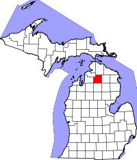
 Location in the U.S. state of Michigan |
||
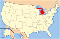
 Michigan's location in the U.S. |
||
| Founded | 1875 | |
| Seat | Gaylord | |
| Largest city | Gaylord | |
| Area | ||
| • Total | 526 sq mi (1,362 km2) | |
| • Land | 514 sq mi (1,331 km2) | |
| • Water | 11 sq mi (28 km2), 2.1% | |
| Population | ||
| • (2010) | 24,164 | |
| • Density | 47/sq mi (18/km²) | |
| Congressional district | 1st | |
| Time zone | Eastern: UTC-5/-4 | |
| Website | www |
|
Otsego County is a county located in the U.S. state of Michigan. As of the 2010 census, the population was 24,164. The county seat is Gaylord. The county was founded in 1840 and organized in 1875.
Otsego may be a Native American name meaning "place of the rock". However, an alternative theory is that it derives from a lake and a county in New York state, which are said to bear the name derived from a Mohawk Iroquoian word meaning either "clear water" or "meeting place." It may be a neologism coined by Henry Schoolcraft, who was a borrower of words and pieces of words from many languages (including Arabic, Greek, Latin, and various American Indian dialects). See List of Michigan county name etymologies.
The county was initially created in 1840 as Okkuddo County (meaning "sickly water," although the reason for using a name with such a negative meaning is lost). The name was changed to Otsego in 1843. It was organized in 1875.
According to the U.S. Census Bureau, the county has a total area of 526 square miles (1,360 km2), of which 515 square miles (1,330 km2) is land and 11 square miles (28 km2) (2.1%) is water. It is the fifth-smallest county by total area in Michigan. The county is considered to be part of Northern Michigan.
Otsego County has more than 370 lakes. Most of the lakes are in the southern part of the county. Three miles south of Gaylord, Otsego Lake, is the county's largest, and has a surface area of 1,972 acres (7.98 km2). Other large lakes in the southern part of the county include Big Lake, Big Bear Lake, Buhl Lake, Crapo Lake, Dixon Lake, Douglas Lake, Guthrie Lake, Heart Lake, Lake Tecon, Manuka Lake, Opal Lake, Pencil Lake, and Turtle Lake. The larger lakes in the northern part of the county are Five Lakes, Hardwood Lake, Lake Twenty Seven, and Pickerel Lake. Many of these are so-called 'kettle lakes,' formed by the melting of blocks of glacial ice, left as the glacier retreated, which created a depression in the soil.
...
Wikipedia

