Otoyo
|
Ōtoyo 大豊町 |
|||
|---|---|---|---|
| Town | |||

Otoyo town hall
|
|||
|
|||
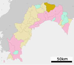
 Location of Ōtoyo in Kōchi Prefecture |
|||
| Location in Japan | |||
| Coordinates: 33°46′N 133°40′E / 33.767°N 133.667°ECoordinates: 33°46′N 133°40′E / 33.767°N 133.667°E | |||
| Country | Japan | ||
| Region | Shikoku | ||
| Prefecture | Kōchi Prefecture | ||
| District | Nagaoka | ||
| Area | |||
| • Total | 314.94 km2 (121.60 sq mi) | ||
| Population (2010) | |||
| • Total | 4,950 | ||
| • Density | 15.7/km2 (41/sq mi) | ||
| Symbols | |||
| • Tree | Japanese cedar | ||
| • Flower | Adonis | ||
| • Bird | Varied tit | ||
| Time zone | Japan Standard Time (UTC+9) | ||
| Website | Town of Ōtoyo | ||
Ōtoyo (大豊町 Ōtoyo-chō) is a town located in Nagaoka District, Kōchi Prefecture, Japan in the mountainous district of central Shikoku. The Yoshino River (吉野川) and Ananai River (穴内川) both flow through Ōtoyo. It is the only municipality in Shikoku where over 50% of the population is aged over 65.
On March 31, 1955 the villages of Higashitoyonaga, Nishitoyonaga, Ōsugi, and Tentsubo joined to form the village of Ōtoyo. The name Ōtoyo came from taking the Ō (大) in Ōsugi (大杉 Ōsugi) and the Toyo (豊 Toyo) in Toyonaga (豊永 Toyonaga). Following this, a section of Ōtoyo was absorbed into the town of Tosayamada (present day Kami, Kōchi). On the April 1, 1972, the village became a town.
The town has two buildings that are recorded on Japan's National Cultural Properties list, Buraku-ji Yakushi-dō and the former Tajikawa Bansho Shoin.
As of 2010, the town has an estimated population of 4,962 and a density of 15.75 persons per km2. The total area is 314.94 km2.
Train
Road
...
Wikipedia


