Opochetsky District
| Opochetsky District Опочецкий район (Russian) |
|
|---|---|
 Location of Opochetsky District in Pskov Oblast |
|
| Coordinates: 56°43′N 28°39′E / 56.717°N 28.650°ECoordinates: 56°43′N 28°39′E / 56.717°N 28.650°E | |
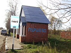
 A bus stop in the village of Purshevo in Opochetsky District |
|
| Location | |
| Country | Russia |
| Federal subject | Pskov Oblast |
| Administrative structure (as of April 2011) | |
| Administrative center | town of Opochka |
| Inhabited localities: | |
| Cities/towns | 1 |
| Rural localities | 519 |
| Municipal structure (as of April 2011) | |
| Municipally incorporated as | Opochetsky Municipal District |
| Municipal divisions: | |
| Urban settlements | 1 |
| Rural settlements | 7 |
| Statistics | |
| Area | 2,028.9 km2 (783.4 sq mi) |
| Population (2010 Census) | 18,673 inhabitants |
| • Urban | 62.1% |
| • Rural | 37.9% |
| Density | 9.2/km2 (24/sq mi) |
| Time zone | MSK (UTC+03:00) |
| Official website | |
| on | |
Opochetsky District (Russian: Опо́чецкий райо́н) is an administrative and municipal district (raion), one of the twenty-four in Pskov Oblast, Russia. It is located in the southwest of the oblast and borders with Pushkinogorsky District in the north, Novorzhevsky District in the northeast, Bezhanitsky District in the east, Pustoshkinsky District in the southeast, Sebezhsky District in the south, and with Krasnogorodsky District in the west. The area of the district is 2,028.9 square kilometers (783.4 sq mi). Its administrative center is the town of Opochka. Population: 18,673 (2010 Census); 23,973 (2002 Census);28,877 (1989 Census). The population of Opochka accounts for 62.1% of the district's total population.
The whole of the district lies in the basin of the Velikaya River, and, consequently, of the Narva River. The Velikaya crosses the district from south to north, and the town of Opochka is located on its banks. The biggest tributaries of the Velikaya within the district are the Issa (left), the Alolya (right), and the Shest (right).
...
Wikipedia
