Oost Gelre
| Oost Gelre | |||
|---|---|---|---|
| Municipality | |||

Monumental post office in Groenlo
|
|||
|
|||
 Location in Gelderland |
|||
| Coordinates: 51°59′N 6°34′E / 51.983°N 6.567°ECoordinates: 51°59′N 6°34′E / 51.983°N 6.567°E | |||
| Country | Netherlands | ||
| Province | Gelderland | ||
| Government | |||
| • Body | Municipal council | ||
| • Mayor | Annette Bronsvoort (PvdA) | ||
| Area | |||
| • Total | 110.12 km2 (42.52 sq mi) | ||
| • Land | 109.67 km2 (42.34 sq mi) | ||
| • Water | 0.45 km2 (0.17 sq mi) | ||
| Elevation | 21 m (69 ft) | ||
| Population (May 2014) | |||
| • Total | 29,657 | ||
| • Density | 270/km2 (700/sq mi) | ||
| Time zone | CET (UTC+1) | ||
| • Summer (DST) | CEST (UTC+2) | ||
| Postcode | 7130–7141, 7263 | ||
| Area code | 0544 | ||
| Website | www |
||
Oost Gelre is a municipality in the Achterhoek, in the eastern Netherlands. On 1 January 2005, the municipalities Groenlo and Lichtenvoorde merged and formed the new municipality Oost Gelre, which was called Groenlo until 19 May 2006.
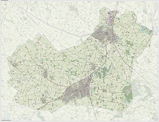
Dutch Topographic map of the municipality of Oost Gelre, June 2015
...
Wikipedia


