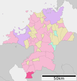
Omuta, Fukuoka
|
Ōmuta 大牟田市 |
|
|---|---|
| City | |
 Location of Ōmuta in Fukuoka Prefecture |
|
| Location in Japan | |
| Coordinates: 33°2′N 130°27′E / 33.033°N 130.450°ECoordinates: 33°2′N 130°27′E / 33.033°N 130.450°E | |
| Country | Japan |
| Region | Kyushu |
| Prefecture | Fukuoka Prefecture |
| Government | |
| • Mayor | Michio Koga |
| Area | |
| • Total | 81.55 km2 (31.49 sq mi) |
| Population (January 1, 2010) | |
| • Total | 127,126 |
| • Density | 1,558.87/km2 (4,037.5/sq mi) |
| Symbols | |
| • Tree | Sawtooth Oak |
| • Flower | Camellia |
| Time zone | Japan Standard Time (UTC+9) |
| City hall address | 836-8666 |
| Website | www |
Ōmuta (大牟田市 Ōmuta-shi?) is a city in Fukuoka Prefecture, Japan.
As of 1 January 2010[update], the city has an estimated population of 127,126 (men 58,294; women 68,832) and a population density of 1,558.87 persons per km². The total area is 81.55 km².
The mayor is Michio Koga.
Ōmuta is located in the southernmost end of Fukuoka Prefecture, is bordered by the Ariake Sea in the west, and meets Kumamoto prefecture to the south and east.
It contains Yamagi and Miike mountains, and the rivers Omuta, Suwa, Doumen and Kumagawa.
Ōmuta's zoo is home to lesser pandas.
The oldest reference to Ōmuta, precisely Kunugi, one of the neighborhoods in the current Ōmuta city, is found in Nihonshoki (720), the chapter of Emperor Keikō, whose historical existence is doubtful.
In the late 12th century, three ponds were formed, supposedly as a result of volcanic activity. Miike, a neighborhood in Ōmuta, is named after those three ponds (jp: " mi-ike").
In 1469, a farmer named Denzaemon eventually found coal in the mountains when he made a bonfire. Coal mining would become the main industry in this area.
During the Edo period, Ōmuta was a part of the Miike han (Miike Domain), ruled by the Tachibana clan who also ruled Yanagawa. In 1721, Ono Harunobu, karō (steward) of Yanagawa han (Yanagawa Domain) was granted Hirano Takatori yama, and started to mine coal. During the 1850s another two coal mines were opened.
...
Wikipedia

