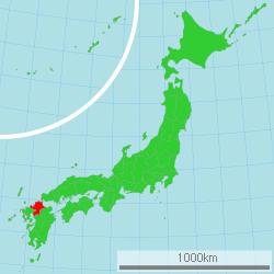
Fukuoka Prefecture
|
Fukuoka Prefecture 福岡県 |
|||
|---|---|---|---|
| Prefecture | |||
| Japanese transcription(s) | |||
| • Japanese | 福岡県 | ||
| • Rōmaji | Fukuoka-ken | ||
|
|||
 |
|||
| Coordinates: 33°36′N 130°35′E / 33.600°N 130.583°ECoordinates: 33°36′N 130°35′E / 33.600°N 130.583°E | |||
| Country | Japan | ||
| Region | Kyushu | ||
| Island | Kyushu | ||
| Capital | Fukuoka City | ||
| Government | |||
| • Governor | Hiroshi Ogawa (since April 2011) | ||
| Area | |||
| • Total | 4,971.01 km2 (1,919.32 sq mi) | ||
| Area rank | 29th | ||
| Population (June 1, 2013) | |||
| • Total | 5,088,483 | ||
| • Rank | 9th | ||
| • Density | 1,020.26/km2 (2,642.5/sq mi) | ||
| ISO 3166 code | JP-40 | ||
| Districts | 12 | ||
| Municipalities | 60 | ||
| Flower | Ume blossom (Prunus mume) | ||
| Tree | Azalea (Rhododendron tsutsusi) | ||
| Bird | Japanese bush warbler (Cettia diphone) | ||
| Website | www.pref.fukuoka.lg.jp/somu/ multilingual/english/top.html |
||
Fukuoka Prefecture (福岡県 Fukuoka-ken?) is a prefecture of Japan located on Kyūshū Island. The capital is the city of Fukuoka.
Fukuoka Prefecture includes the former provinces of Chikugo, Chikuzen, and Buzen.
Kōra taisha, Sumiyoshi-jinja, and Hakosagi-gū are the chief Shinto shrines (ichinomiya) in the prefecture.
Fukuoka Prefecture faces the sea on three sides, bordering on Saga, Ōita, and Kumamoto prefectures and facing Yamaguchi Prefecture across the Kanmon Straits.
As of 1 April 2012, 18% of the total land area of the prefecture was designated as Natural Parks, namely Setonaikai National Park, Genkai, Kitakyūshū, and Yaba-Hita-Hikosan Quasi-National Parks, and Chikugogawa, Chikuhō, Dazaifu, Sefuri Raizan, and Yabegawa Prefectural Natural Parks.
...
Wikipedia


