Okinoerabujima
| Japanese: Okinoerabujima (沖永良部島?) Amami: Yyerabu (っイェラブ?) Kunigami: Iraabu (いラーブ?) |
|
|---|---|

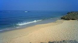
Yakomo beach on Okinoerabujima
|
|
| Geography | |
| Location | East China Sea |
| Coordinates | 27°22′08″N 128°34′00″E / 27.36889°N 128.56667°ECoordinates: 27°22′08″N 128°34′00″E / 27.36889°N 128.56667°E |
| Archipelago | Amami Islands |
| Area | 93.63 km2 (36.15 sq mi) |
| Length | 20 km (12 mi) |
| Width | 7 km (4.3 mi) |
| Coastline | 50 km (31 mi) |
| Highest elevation | 246 m (807 ft) |
| Highest point | Ōyama |
| Administration | |
|
Japan
|
|
| Prefectures | Kagoshima Prefecture |
| District | Ōshima District |
| Demographics | |
| Population | 15,000 (2013) |
| Pop. density | 150 /km2 (390 /sq mi) |
| Ethnic groups | Japanese |
Okinoerabujima (沖永良部島?, Amami: っイェラブ Yyerabu; Kunigami: いラーブ Iraabu) is one of the Satsunan Islands, classed with the Amami archipelago between Kyūshū and Okinawa.
The island, 93.63 km² in area, has a population of approximately 15,000 persons. Administratively it is divided into the towns of Wadomari and China in Kagoshima Prefecture. Much of the island is within the borders of the Amami Guntō Quasi-National Park.
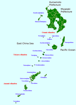
Okinoerabujima is isolated from the other Amami islands, and is located in between Tokunoshima and Yoronjima, approximately 536 kilometres (289 nmi) south of the southern tip of Kyūshū and 60 kilometres (32 nmi) north of Okinawa.
The island is an elevated coralline island with a length of approximately 20 kilometres (12 mi) and width of 7 kilometres (4.3 mi), with Mount Ōyama at 246 metres (807 ft) above sea level at its highest peak. . In the eastern part of the island is an extensive limestone cave system, one of the largest in Asia. The coast of the island is surrounded by a coral reef.
Okinoerabujima has a humid subtropical climate (Köppen climate classification Cfa) with very warm summers and mild winters. Precipitation is significant throughout the year, but is somewhat lower in winter. The island is subject to frequent typhoons.
...
Wikipedia

