
Oehringen
| Öhringen | ||
|---|---|---|
 |
||
|
||

Öhringen
|
||
|
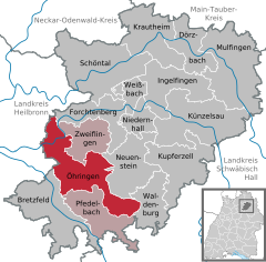
Location of Öhringen within Hohenlohekreis district
  |
||
| Coordinates: 49°12′N 9°30′E / 49.200°N 9.500°ECoordinates: 49°12′N 9°30′E / 49.200°N 9.500°E | ||
| Country | Germany | |
| State | Baden-Württemberg | |
| Admin. region | Stuttgart | |
| District | Hohenlohekreis | |
| Government | ||
| • Mayor | Thilo Michler (no party) | |
| Area | ||
| • Total | 67.79 km2 (26.17 sq mi) | |
| Elevation | 230 m (750 ft) | |
| Population (2015-12-31) | ||
| • Total | 23,489 | |
| • Density | 350/km2 (900/sq mi) | |
| Time zone | CET/CEST (UTC+1/+2) | |
| Postal codes | 74613 | |
| Dialling codes | 07941 | |
| Vehicle registration | KÜN | |
| Website | www.oehringen.de | |

Öhringen is the largest town in Hohenlohe (district) in the state of Baden-Württemberg, in southwest Germany, near Heilbronn. Öhringen is on the railways to Schwäbisch Hall and Crailsheim.
With a population of 22,745 (2009), the town is diverse. It is a quaint medieval place, and, among its ancient buildings, boasts a fine Evangelical church (German: Stiftskirche) containing carvings in cedar-wood from the 15th century and numerous interesting tombs and monuments; a Renaissance town hall; the building, now used as a library, which formerly belonged to a monastery, erected in 1034; and a palace, the former residence of the princes of Hohenlohe-Öhringen.
Öhringen was known as Vicus Aurelii to the Romans. Eastwards of it runs the old Limes Roman frontier wall, and numerous remains and inscriptions dating from the days of the Roman settlement have been discovered, including traces of three camps.
Öhringen is located in the western, deeper part of the Hohenlohe plain, between the Keuper stage of the Swabian-Franconian Forest and the Kocher valley. The town spreads out over the flat valley of Ohrn, a small river, which flows about 10 kilometres (6 mi) down the valley in the district Ohrnberg into the Kocher river. The town is situated between elevation 168 metres (551 ft), in the Kocher at the county border at Möglingen, and 486 m (1,594 ft), already above the forest on the Charles Mainhardt Furter plane, which belongs to the district Michelbach. The height of the town itself varies between 215–280 metres (705–919 ft).
The Öhringen area drains to the Kocher river, which runs between Ohrnberg and Sindringen, about 3 kilometres (2 miles) upstream from Ohrnberg mountain. The river leaves the region 6 km (4 miles) west of the district Möglingen. The Ohrn has created a broad, flat valley in the northwest of the borough and at Möhrig. From Unterohrn, the Ohrn extends to the confluence with the Kocher in the hard layers of the mussel limestone and has cut a deep valley. This section of the river course was declared Ohrntal in 1963 for the conservation area. The Maßholderbach and the Westernbach streams, which flow northwest of the town itself in the Ohrn, also create flat valleys in the northeastern part of the district.
...
Wikipedia