Odernheim am Glan
| Odernheim am Glan | ||
|---|---|---|

Staudernheimer Straße 1 – former estate mill
|
||
|
||
| Coordinates: 49°45′55.48″N 7°42′17.28″E / 49.7654111°N 7.7048000°ECoordinates: 49°45′55.48″N 7°42′17.28″E / 49.7654111°N 7.7048000°E | ||
| Country | Germany | |
| State | Rhineland-Palatinate | |
| District | Bad Kreuznach | |
| Municipal assoc. | Bad Sobernheim | |
| Government | ||
| • Mayor | Achim Schick (CDU) | |
| Area | ||
| • Total | 13.26 km2 (5.12 sq mi) | |
| Elevation | 141 m (463 ft) | |
| Population (2015-12-31) | ||
| • Total | 1,686 | |
| • Density | 130/km2 (330/sq mi) | |
| Time zone | CET/CEST (UTC+1/+2) | |
| Postal codes | 55571 | |
| Dialling codes | 06755 | |
| Vehicle registration | KH | |
| Website | www.odernheim.de | |
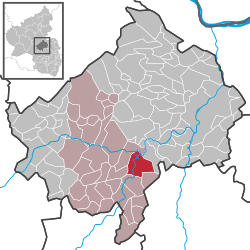
Odernheim am Glan is an Ortsgemeinde – a municipality belonging to a Verbandsgemeinde, a kind of collective municipality – in the Bad Kreuznach district in Rhineland-Palatinate, Germany. It belongs to the Verbandsgemeinde of Bad Sobernheim, whose seat is in the like-named town. Odernheim is a winegrowing village.
Odernheim lies at the edge of the North Palatine Uplands at the mouth of the River Glan, where it empties into the River Nahe. This village, lying at the foot of the Disibodenberg, an important monastic centre in the Middle Ages, is surrounded by vineyards, forests and meadows in the southeastern part of the Verbandsgemeinde of Bad Sobernheim, and in the middle of the Nahe wine region. Among nearby towns, the Verbandsgemeinde seat of Bad Sobernheim lies 4 km to the northwest, the district seat of Bad Kreuznach 16 km to the northeast, Kirn 20 km to the west and Meisenheim 7 km to the south. Farther afield, Bingen am Rhein lies roughly 27 km to the northnortheast, while to the northeast lie Mainz (48 km), Wiesbaden just beyond and Frankfurt (80 km)
...
Wikipedia


