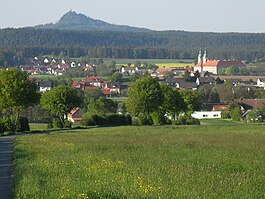
Oberkulm
| Oberkulm | ||
|---|---|---|
 |
||
|
||
| Coordinates: 47°18′N 8°7′E / 47.300°N 8.117°ECoordinates: 47°18′N 8°7′E / 47.300°N 8.117°E | ||
| Country | Switzerland | |
| Canton | Aargau | |
| District | Kulm | |
| Area | ||
| • Total | 9.41 km2 (3.63 sq mi) | |
| Elevation | 476 m (1,562 ft) | |
| Population (Dec 2015) | ||
| • Total | 2,692 | |
| • Density | 290/km2 (740/sq mi) | |
| Postal code | 5727 | |
| SFOS number | 4140 | |
| Surrounded by | Dürrenäsch, Gontenschwil, Schlossrued, Schmiedrued, Unterkulm, Zetzwil | |
| Website |
www SFSO statistics |
|
Oberkulm is a municipality in the district of Kulm, in the canton of Aargau in Switzerland.
Oberkulm is first mentioned in 1045 as Chulenbare, though this is for both Oberkulm and Unterkulm. In 1295 Oberkulm, individually, was mentioned as Obern Chulnbe. The earliest evidence of a settlement is a Celtic gold coin from the 1st Century BC. During the Roman era Oberkulm was the site of a Roman estate (villa columbaria, 1756–58 and 1902 excavations) and Alamanni graves, both from the 1st Century AD. In the 13th Century the village was possessed the Habsburgs, Beromünster Abbey and the Lords of Reinach. From 1415 until 1798 it belonged to Bern as part of the bailiwick of Lenzburg. In 1433 the rights to high justice were purchased from the Austrian county of Lenzburg by the city of Bern. Low justice was, starting in 1306, in the possession of the Herrschaft of Rued, but was sold in 1517 to Bern.
The Protestant Reformation was introduced in 1528. Ecclesiastically Oberkulm has always been part of the parish of Kulm. The parish church is located in Unterkulm.
Towards the middle of the 18th Century, small scale cotton spinning and weaving became common in the village. At the beginning of the 21st Century there were various small industrial enterprises. About 60% of the working population, work in the industrial sector while about 26% work in the services sector. A regional retirement home was built in the municipality in 1979.
...
Wikipedia


