Beromünster
| Beromünster | ||
|---|---|---|
 |
||
|
||
| Coordinates: 47°12′N 8°12′E / 47.200°N 8.200°ECoordinates: 47°12′N 8°12′E / 47.200°N 8.200°E | ||
| Country | Switzerland | |
| Canton | Lucerne | |
| District | Sursee | |
| Area | ||
| • Total | 42.17 km2 (16.28 sq mi) | |
| Elevation | 642 m (2,106 ft) | |
| Population (Dec 2015) | ||
| • Total | 6,445 | |
| • Density | 150/km2 (400/sq mi) | |
| Postal code | 6215 | |
| SFOS number | 1081 | |
| Localities | Schwarzenbach | |
| Surrounded by | Aesch, Beinwil am See (AG), Ermensee, Gunzwil, Menziken (AG), Mosen | |
| Website |
www Profile (German), SFSO statistics |
|
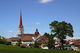
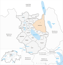
Beromünster is a municipality in the district of Sursee in the canton of Lucerne in Switzerland. On 1 January 2004 the former municipality of Schwarzenbach merged into the municipality of Beromünster. On 1 January 2009 the former municipality of Gunzwil merged into the municipality of Beromünster followed by Neudorf on 1 January 2013.
Beromünster is first mentioned in 1223 as villa Beronensis. In 1333 it was mentioned as Münster in Ergöwe. Until 1934 it was known simply as Münster (LU).
Beromünster has an area of 42.17 km2 (16.28 sq mi). Of this area, 64.7% is used for agricultural purposes, while 21.1% is forested. Of the rest of the land, 14.1% is settled (buildings or roads) and the remainder (0.2%) is non-productive (rivers, glaciers or mountains). In the 1997 land survey[update], 16.32% of the total land area was forested. Of the agricultural land, 72.03% is used for farming or pastures, while 3.54% is used for orchards or vine crops. Of the settled areas, 4.29% is covered with buildings, 0.24% is industrial, 0.68% is classed as special developments, 0.27% is parks or greenbelts and 2.49% is transportation infrastructure. Of the unproductive areas, 0.1% is unproductive flowing water (rivers) and 0.03% is other unproductive land.
The municipality is located in the upper Wynental. It consists of two separate settlements, Flecken in a depression and the church owned village of Beromünster on the western side of a hill. Flecken consists of three rows of houses, built following a fire in 1764, along the main and parallel side road. Since 1 January 2009 it has also included the municipality of Gunzwil. The merged municipality in 2009 had an area of 29.35 km2 (11.33 sq mi).
Beromünster has a population (as of 31 December 2015) of 6,445. As of 2007[update], 13.4% of the population was made up of foreign nationals. The combined municipality has a population of 4,588 of which 10.1% are foreign. Over the last 10 years the population has grown at a rate of 2.1%. Most of the population (as of 2000[update]) speaks German (90.1%), with Albanian being second most common ( 4.6%) and Serbo-Croatian being third ( 2.1%).
...
Wikipedia


