Nur, Poland
| Nur | |
|---|---|
| Village | |
 |
|
| Coordinates: 52°40′N 22°18′E / 52.667°N 22.300°E | |
| Country |
|
| Voivodeship | Masovian |
| County | Ostrów Mazowiecka |
| Gmina | Nur |
| Population | 760 |
| Website | http://www.gminanur.pl |
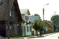
Nur [nur] is a village in Ostrów Mazowiecka County, Masovian Voivodeship, in east-central Poland. It is the seat of the gmina (administrative district) called Gmina Nur. It lies approximately 31 kilometres (19 mi) south-east of Ostrów Mazowiecka and 102 km (63 mi) north-east of Warsaw.
In 2006, the village had a population of 760.
Nur has a long and rich history. In the Kingdom of Poland, it was one of main administrative centers of the province of Mazovia, and the seat of a separate administrative district (ziemia). In the early Middle Ages, Nur was a trade center, with a Roman Catholic parish established here probably in the 12th century.
Nur received its town charter either in 1410, or 1425. A local vogt was established, with town council. Until 1526, Nur was part of the Duchy of Mazovia, which was a Polish vassal. After annexation of Mazovia into Poland, and creation of Masovian Voivodeship, the Land of Nur consisted of three counties: Kamieniec Mazowiecki, Ostrów Mazowiecka, and Nur, which also was the seat of a starosta, Sejmik, and land court for the three counties.
The Land of Nur had been established in 1377, during a meeting of Mazovian dukes in Sochaczew. Its total area was 3,500 km2.: Kamieniec Castellany, later renamed into Kamieniec County, had the area of 2,000 km2., Nur County 1,000 km2., and Ostrow County 500 km2. Boundaries of the Land of Nur remained unchanged for over 400 years, until the Partitions of Poland.
...
Wikipedia

