Masovian Voivodeship
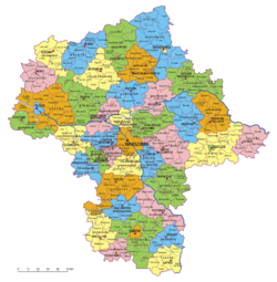
Masovian Voivodeship or Mazovia Province (Polish: województwo mazowieckie [vɔjɛˈvutstfɔ mazɔˈvjɛtskʲɛ]), is the largest and most populous of the sixteen Polish provinces, or voivodeships, created in 1999. It occupies 35,579 square kilometres (13,737 sq mi) of east-central Poland, and has 5,324,500 inhabitants. Its principal cities are Warsaw (1.729 million) in the centre of the Warsaw metropolitan area, Radom (226,000) in the south, Płock (127,000) in the west, Siedlce (77,000) in the east, and Ostrołęka (55,000) in the north. The capital of the voivodeship is the national capital, Warsaw.
The province was created on January 1, 1999, out of the former Warsaw, Płock, Ciechanów, Ostrołęka, Siedlce and Radom Voivodeships, pursuant to the Polish local government reforms adopted in 1998. The province's name recalls the traditional name of the region, Mazowsze (sometimes rendered in English as "Masovia"), with which it is roughly coterminous. However, southern part of the voivodeship, with Radom, historically belongs to Małopolska (Lesser Poland), while Łomża and its surroundings, even though historically part of Masovia, now is part of Podlaskie Voivodeship.
...
Wikipedia


