Nozhay-Yurtovsky District
| Nozhay-Yurtovsky District Ножай-Юртовский район (Russian) Ножи-Юртан кӏошт (Chechen) |
|
|---|---|
 Location of Nozhay-Yurtovsky District in the Chechen Republic |
|
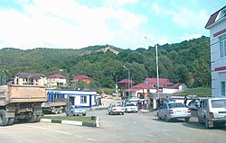
 Scene in Nozhay-Yurtovsky |
|
| Location | |
| Country | Russia |
| Federal subject | Chechen Republic |
| Administrative structure (as of November 2005) | |
| Administrative center | selo of Nozhay-Yurt |
| Administrative divisions: | |
| rural administration | 22 |
| Inhabited localities: | |
| Rural localities | 53 |
| Municipal structure (as of June 2010) | |
| Municipally incorporated as | Nozhay-Yurtovsky Municipal District |
| Municipal divisions: | |
| Urban settlements | 0 |
| Rural settlements | 22 |
| Statistics | |
| Area | 629 km2 (243 sq mi) |
| Population (2010 Census) | 49,445 inhabitants |
| • Urban | 0% |
| • Rural | 100% |
| Density | 78.61/km2 (203.6/sq mi) |
| Time zone | MSK (UTC+03:00) |
| Official website | |
| on | |
Nozhay-Yurtovsky District (Russian: Ножа́й-Ю́ртовский райо́н; Chechen: Ножи-Юртан кӏошт) is an administrative and municipal district (raion), one of the fifteen in the Chechen Republic, Russia. It is located in the east of the republic. The area of the district is 629 square kilometers (243 sq mi). Its administrative center is the rural locality (a selo) of Nozhay-Yurt. Population: 49,445 (2010 Census); 40,542 (2002 Census);48,770 (1989 Census). The population of Nozhay-Yurt accounts for 13.6% of the district's total population.
Overall health performance indicators of the district are much worse than officially reflected, considering the remote geographic location of the district and that most of its populace has limited access to state health care. As of 2004, the mortality rates were among the highest in the republic.
Coordinates: 43°05′45″N 46°22′35″E / 43.09583°N 46.37639°E
...
Wikipedia
