Novouralsk
| Novouralsk (English) Новоуральск (Russian) |
|
|---|---|
| - Town - | |
 In Novouralsk |
|
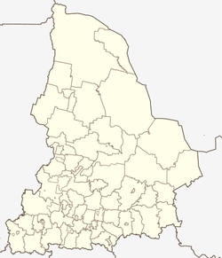
 Location of Sverdlovsk Oblast in Russia |
|
|
|
|
|
|
|
|
|
|
| Administrative status (as of 2013) | |
| Country | Russia |
| Federal subject | Sverdlovsk Oblast |
| Administratively subordinated to | closed administrative-territorial formation of Novouralsk |
| Administrative center of | closed administrative-territorial formation of Novouralsk |
| Municipal status (as of April 2014) | |
| Urban okrug | Novouralsky Urban Okrug |
| Administrative center of | Novouralsky Urban Okrug |
| Head | Valery Popov |
| Statistics | |
| Population (2010 Census) | 85,522 inhabitants |
| - Rank in 2010 | 195th |
| Time zone | YEKT (UTC+05:00) |
| Founded | 1941 |
| Town status since | 1954 |
| Postal code(s) | 624130-624139 |
| Dialing code(s) | +7 34370 |
|
|
|
| on | |
Novouralsk (Russian: Новоура́льск) is a closed town in Sverdlovsk Oblast, Russia, located on the eastern side of the Ural Mountains, about 70 kilometers (43 mi) north of Yekaterinburg, the administrative center of the oblast. Population: 85,522 (2010 Census);95,414 (2002 Census).
It was formerly known as Sverdlovsk-44 (Свердло́вск-44). Although it came into being during World War II and was named Novouralsk in 1954, it was kept secret until 1994. It has had closed town status since its establishment.
Within the framework of the administrative divisions, it is, together with five rural localities, incorporated as the closed administrative-territorial formation of Novouralsk—an administrative unit with the status equal to that of the districts. As a municipal division, the closed administrative-territorial formation of Novouralsk is incorporated as Novouralsky Urban Okrug.
The town is laid out in a grid format, divided north/south by the central street on which the main administrative building is located. It is subdivided into five residential districts, each covering 10,000 hectares. The town's economy is dominated by the nuclear, automobile, and construction industries.
...
Wikipedia


