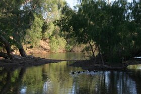
Normanby River
| Normanby | |
| East Normanby, West Normanby, East Normanby North Branch, East Normanby South Branch, Granite Normanby | |
| River | |
| Name origin: In honour of George Phipps, 2nd Marquess of Normanby | |
| Country | Australia |
|---|---|
| State | Queensland |
| Region | Far North Queensland, Cape York Peninsula, Wet Tropics of Queensland |
| Tributaries | |
| - left | Banana Creek (Queensland), Beardmore Creek, Cabbage Tree (Welcome) Creek, Laura River, Kennedy River |
| - right | Nigger Creek (Queensland), Surrender Creek, Trapp Creek, Bridge Creek (Queensland), Jack River (Queensland), House Creek (Queensland) |
| Source | Great Dividing Range |
| - location | west of Wajul Wajul |
| - coordinates | 15°55′S 145°12′E / 15.917°S 145.200°E |
| Source confluence | East and West Normanby Rivers |
| - elevation | 125 m (410 ft) |
| - coordinates | 15°39′39″S 144°56′17″E / 15.66083°S 144.93806°E |
| Mouth | Princess Charlotte Bay |
| - location | Lakefield National Park |
| - elevation | 0 m (0 ft) |
| - coordinates | 14°23′47″S 144°08′37″E / 14.39639°S 144.14361°ECoordinates: 14°23′47″S 144°08′37″E / 14.39639°S 144.14361°E |
| Length | 350 km (217 mi) |
| Basin | 24,408 km2 (9,424 sq mi) |
| Discharge | for Princess Charlotte Bay |
| - average | 390 m3/s (13,773 cu ft/s) |
| National park | Lakefield National Park |
|
Location of Normanby River river mouth in Queensland
|
|
The Normanby River, comprising the East Normanby River, the West Normanby River, the East Normanby River North Branch, the East Normanby River South Branch and the Granite Normanby River, is a river system located in Far North Queensland, Australia.
With its headwaters in the Great Dividing Range west of Wajul Wajul in the Wet Tropics of Queensland, the Normanby River is formed by the confluence of the East and West Branches of the river at an elevation of 125 metres (410 ft) AHD . The river flows generally north-northwestw through seasonally flooded savanna grassland to reach its mouth in Princess Charlotte Bay about 150 kilometres (93 mi) northwest of Cooktown. The river is joined by 18 tributaries including the Laura River. The river flows through the Lakefield National Park, which covers as much as a fifth of the river's basin and is completely impassable during the wet season between November and May. The Lakefield National Park consists of large wetlands which possess a high diversity of fish species. Near its mouth, the Normanby River flows very slowly and forms a large delta, which is almost inaccessible even during the dry season as there are no roads - even unsealed ones. This land, though, is still dry enough during the dry season that tropical rainforests cannot grow.
...
Wikipedia


