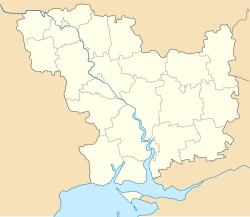
Nikolayev (Ukraine)
| Mykolaiv (Миколаїв) Nikolaev (Николаев) |
|||
|---|---|---|---|
| City of regional significance | |||
![City Hall of Mykolaiv in 2006. The star, reminiscent of the Soviet era Red star still visible in this picture, was replaced on November 2016 by the coat of arms of Ukraine.[1]](http://upload.wikimedia.org/wikipedia/commons/thumb/f/fa/%D0%97%D0%B4%D0%B0%D0%BD%D0%B8%D0%B5_%D0%93%D0%BE%D1%80%D0%BA%D0%BE%D0%BC%D0%B0_%D0%B2_%D0%9D%D0%B8%D0%BA%D0%BE%D0%BB%D0%B0%D0%B5%D0%B2%D0%B5.jpg/250px-%D0%97%D0%B4%D0%B0%D0%BD%D0%B8%D0%B5_%D0%93%D0%BE%D1%80%D0%BA%D0%BE%D0%BC%D0%B0_%D0%B2_%D0%9D%D0%B8%D0%BA%D0%BE%D0%BB%D0%B0%D0%B5%D0%B2%D0%B5.jpg)
City Hall of Mykolaiv in 2006. The star, reminiscent of the Soviet era Red star still visible in this picture, was replaced on November 2016 by the coat of arms of Ukraine.
|
|||
|
|||
| Nickname(s): City of shipbuilders | |||
| Location of Ukraine | |||
| Coordinates: 46°58′0″N 32°00′0″E / 46.96667°N 32.00000°ECoordinates: 46°58′0″N 32°00′0″E / 46.96667°N 32.00000°E | |||
| Country |
|
||
| Oblast | Mykolaiv Oblast | ||
| Raion | Mykolaiv Municipality | ||
| Founded | 1789 | ||
| City rights | 1789 | ||
| Government | |||
| • Mayor | Oleksandr Senkevych (Self Reliance) | ||
| Area | |||
| • Total | 260 km2 (100 sq mi) | ||
| Population (2015) | |||
| • Total | 494,763 | ||
| • Density | 1,918/km2 (4,970/sq mi) | ||
| Time zone | EET (UTC+2) | ||
| • Summer (DST) | EEST (UTC+3) | ||
| Postal code | 54000 | ||
| Area code(s) | +380 512 | ||
| Vehicle registration | BE | ||
| Website | mkrada.gov.ua/ | ||
Mykolaiv (Ukrainian: Миколаїв Ukrainian pronunciation: [mɪkoˈlɑjiu̯]), also known as Nikolaev or Nikolayev (from Russian Николаев), is a city in southern Ukraine, the administrative center of the Mykolaiv Oblast. Mykolaiv is arguably the main ship building center of the Black Sea. Aside from its three shipyards within the city, there are located a number of research centers specializing in shipbuilding such as the State Research and Design Shipbuilding Center, Zoria-Mashproekt and others. Population: 494,763 (2015 est.)
The city is an important transportation junction of Ukraine (sea port, commercial port, river port, highway and railway junction, airport).
Mykolaiv's orderly layout reflects the fact that its development has been well planned from the founding of the city. Its main streets, including the three main east–west Avenues, are very wide and tree lined. A significant part of Mykolaiv's land area consists of beautiful parks. Park Peremohy (Victory) is a large park on the peninsula just north of the city center of Mykolaiv, on the north side of the Inhul river.
The city uses two names, Ukrainian and Russian; there are several transliterations of each name. The Ukrainian name of the city is Микола́їв, transliterated as Mykolaiv, or (officially) Mykolayiv. The Russian name, Никола́ев, transliterates as Nikolaev or as Nikolayev.
The city's founding was made possible by the Russian conquests during the Second Russo-Turkish War of 1787-1792. Founded by Prince Grigory Potemkin, Nikolaev was the last of the many cities he established. On 27 August 1789, Potemkin ordered its naming near the wharf at the mouth of the Ingul river, on a high, cool and breezy spot where the Ingul river meets the Southern Bug river. To build the city he brought in peasants, soldiers, and Turkish prisoners; 2,500 were working there during 1789. The shipyards were built first (1788). Potemkin named the city after Saint Nicholas, the patron of seafarers, on whose day (6 December) he had obtained victory at the siege of Ochakov in 1788. The name Nikolaev is known from the legal order (writ) Number 1065 by Prince Potemkin to Mikhail Faleev dated 27 August 1789.
...
Wikipedia


