Nickel Belt (electoral district)
|
|
|||
|---|---|---|---|

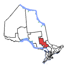
Nickel Belt in relation to other Ontario electoral districts
|
|||
| Federal electoral district | |||
| Legislature | House of Commons | ||
| MP |
Liberal |
||
| District created | 1952 | ||
| First contested | 1953 | ||
| Last contested | 2015 | ||
| District webpage | profile, map | ||
| Demographics | |||
| Population (2011) | 90,962 | ||
| Electors (2015) | 72,134 | ||
| Area (km²) | 30,490 | ||
| Pop. density (per km²) | 3 | ||
| Census divisions | Greater Sudbury, Sudbury District plus small portions of Timiskaming, Manitoulin, Nipissing and Parry Sound | ||
| Census subdivisions | Biscotasing, Cartier, French River, Gogama, Greater Sudbury, Killarney, Markstay-Warren, St. Charles, West Nipissing, Whitefish Lake | ||
Nickel Belt is one of two federal electoral districts serving the city of Greater Sudbury, Ontario, Canada. It has been represented in the House of Commons of Canada since 1953.
It consists of:
The riding of Nickel Belt was created in 1952 from parts of Algoma East, Algoma—Manitoulin, Nipissing, Parry Sound—Muskoka, Sudbury and Timiskaming—Cochrane ridings. It has traditionally included much of the Sudbury District and small parts of the Algoma, Nipissing and Timiskaming Districts, along with all but the urban core of Greater Sudbury.
It consisted initially of parts of the territorial districts of Sudbury and Algoma, and excluding the city of Sudbury, town of Copper Cliff, and the township of McKim. In 1966, it was redefined to consist of parts of the territorial districts of Sudbury excluding the City of Sudbury and the Town of Copper Cliff, and the northeast part of the territorial district of Manitoulin.
In 1976, it was redefined to consist of the southern part of Regional Municipality of Sudbury, the southeast part of the Territorial District of Sudbury, and the part of the Territorial District of Manitoulin including and lying east of the Townships of Killarney, and Rutherford and George Island.
In 1987, it was redefined to consist of the southern part of the Regional Municipality of Sudbury; the geographic townships of Cartier, Cascaden, Foy, Hart, Harty, Hess and Moncrieff and that part of the geographic Township of Trill not within the Town of Walden in the Territorial District of Sudbury; Wahnapitei Indian Reserve No. 11; and Whitefish Lake Indian Reserve No. 6.
...
Wikipedia
