Ngauruhoe
| Mount Ngauruhoe | |
|---|---|

Ngauruhoe seen from Mount Tongariro
|
|
| Highest point | |
| Elevation | 2,291 m (7,516 ft) |
| Coordinates | 39°09′24.6″S 175°37′55.8″E / 39.156833°S 175.632167°ECoordinates: 39°09′24.6″S 175°37′55.8″E / 39.156833°S 175.632167°E |
| Naming | |
| Pronunciation | Māori: [ŋaːʉɾʉhɔɛ] |
| Geography | |
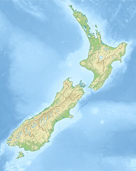
| Location | North Island, New Zealand |
| Geology | |
| Mountain type | Stratovolcano (active) |
| Volcanic arc/belt | Taupo Volcanic Zone |
| Last eruption | 1977 |
| Climbing | |
| First ascent | March 1839 by John C. Bidwill an English botanist.Two Maori guides came with him to within 1 kilometre of the peak. |
| Easiest route | Scramble (summer) |
Mount Ngauruhoe is an active stratovolcano or composite cone in New Zealand, made from layers of lava and tephra. It is the youngest vent in the Tongariro volcanic complex on the Central Plateau of the North Island, and first erupted about 2,500 years ago. Although seen by most as a volcano in its own right, it is technically a secondary cone of Mount Tongariro.
The volcano lies between the active volcanoes of Mount Tongariro to the north and Mount Ruapehu to the south, to the west of the Rangipo Desert and 25 kilometres to the south of the southern shore of Lake Taupo.
The volcano was named by Ngātoro-i-rangi, an ancestor of the local Māori iwi, Ngāti Tūwharetoa. Local traditions say that Ngātoro-i-rangi called volcanic fire from his homeland Hawaiki which eventually emerged at Ngauruhoe. The name either commemorates his slave, who had died from the cold before the fire arrived, or refers to the insertions (ngā uru) of his hoe (paddle-like staff) into the ground.
Ngauruhoe erupted 45 times in the 20th century, most recently in 1974.Fumaroles exist inside the inner crater and on the rim of the eastern, outer crater. Climbers who suffer from asthma may be affected by the strong sulphurous gases emitted from the crater.
Ngauruhoe is no longer showing signs of any significant unrest and the Volcanic Alert Level has been reduced to zero (typical background activity).
A significant increase in earthquake activity in May 2006 prompted the alert level to be raised to one (signs of volcano unrest). Over the next two years GeoNet recorded an average of 5 to 30 earthquakes a day close to Ngauruhoe, though the maximum daily number was as high as 80.
Since mid-2008 the number of volcanic earthquakes close to Ngauruhoe has declined to the background level. Regular measurements of volcanic gas levels and the temperature of a summit gas vent have failed to record any significant changes over the last two and a half years. “Since mid-2008 the number of earthquakes has returned to a typical level of a few per week” GNS Science accordingly reduced the alert level for Ngauruhoe to Level 0 on 2 December 2008. “The reduction in earthquake activity means that an eruption in the near future is unlikely without further earthquakes or other changes and the appropriate alert level is therefore zero”, said GNS Science Volcano Section Manager Gill Jolly.
...
Wikipedia

