Newcastle, Texas
| Newcastle, Texas | |
|---|---|
| City | |

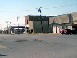
Downtown Newcastle.
|
|
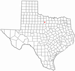
 Location of Newcastle, Texas |
|
 |
|
| Coordinates: 33°11′33″N 98°44′17″W / 33.19250°N 98.73806°WCoordinates: 33°11′33″N 98°44′17″W / 33.19250°N 98.73806°W | |
| Country | United States |
| State | Texas |
| County | Young |
| Government | |
| • Mayor | Gina Maxwell |
| Area | |
| • Total | 1.8 sq mi (4.7 km2) |
| • Land | 1.8 sq mi (4.7 km2) |
| • Water | 0.0 sq mi (0.0 km2) |
| Elevation | 1,142 ft (348 m) |
| Population (2010) | |
| • Total | 585 |
| • Density | 330/sq mi (120/km2) |
| Time zone | Central (CST) (UTC-6) |
| • Summer (DST) | CDT (UTC-5) |
| ZIP code | 76372 |
| Area code(s) | 940 |
| FIPS code | 48-50868 |
| GNIS feature ID | 1363841 |
Newcastle is a city in Young County, Texas, United States. Following the beginning of coal mining in 1908, the town was established and named for the English coal town, Newcastle upon Tyne. Coal mining had ended by 1942. The population was 585 at the 2010 census.
Beginning in 1906, the Wichita Falls and Southern Railroad, one of the numerous Frank Kell and Joseph A. Kemp properties, connected Wichita Falls with the coal fields in Newcastle. The WF&S was later acquired and consolidated with other shorter lines by the Missouri-Kansas-Texas Railroad.
Newcastle is located at 33°11′33″N 98°44′17″W / 33.19250°N 98.73806°W (33.192383, -98.737969).
According to the United States Census Bureau, the city has a total area of 1.8 square miles (4.7 km²), all of it land.
As of the census of 2000, 575 people, 233 households, and 157 families resided in the city. The population density was 317.5 people per square mile (122.7/km²). The 266 housing units averaged 146.9 per square mile (56.7/km²). The racial makeup of the city was 93.91% White, 1.39% African American, 1.04% Native American, 2.26% from other races, and 1.39% from two or more races. Hispanics or Latinos of any race were 5.57% of the population.
...
Wikipedia
