New River (Mexico–United States)
| New River | |
|---|---|

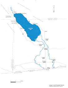
Map of the New River (left) Watershed; Alamo River on the right.
|
|
| Native name | Río Nuevo |
| Country | United States, Mexico |
| Basin features | |
| Main source | near Cerro Prieto,Mexicali Municipality, Baja California, Mexico 32°22′45″N 115°14′37″W / 32.379164°N 115.243664°W |
| River mouth |
Salton Sea, Imperial County, California 33°07′53″N 115°41′40″W / 33.131316°N 115.694479°WCoordinates: 33°07′53″N 115°41′40″W / 33.131316°N 115.694479°W |
| Physical characteristics | |
| Length | 125 km (78 mi) |
| Discharge |
|
The New River (Spanish: Río Nuevo) flows north from near Cerro Prieto, through the city of Mexicali, Baja California, Mexico, into the United States through the city of Calexico, California, towards the Salton Sea. The river channel has existed since pre-historic times; however, the river as known today was formed from a levee failure that resulted in massive flooding that re-created the Salton Sea. Today, the river flow is not natural, mostly consisting of agricultural runoff, municipal discharge and industrial dumping. The river has been referred to as the most severely polluted river of its size within the United States. Several projects have begun to reduce and mitigate the levels of pollution in the river, including upgrading sewage treatment infrastructure and enclosing the river channel.
The New River channel begins at a volcanic lake, near Cerro Prieto. Today this lake feeds the Cerro Prieto Geothermal Power Station. The river flows north 15 miles (24 km) through Baja California and another 66 miles (106 km) through California into the Salton Sea, the largest lake in California. Flow at the border is approximately 200 cu ft/s (5.7 m3/s), and about three times this flow at the Salton Sea because of collected agricultural discharges.
The New River’s flow is composed of waste from agricultural and chemical runoff from the farm industry irrigation in the U.S. (18.4%) and Mexico (51.2%), sewage from Mexicali (29%), and manufacturing plants operating in Mexico (1.4%). By the time the New River crosses the Mexico–U.S. border near Calexico, California, the channel contains a stew of about 100 contaminants: volatile organic compounds, heavy metals (including selenium, uranium, arsenic and mercury), and pesticides (including DDT) and PCBs. The waterway also holds the pathogens that cause tuberculosis, encephalitis, polio, cholera, hepatitis and typhoid; levels for many of these contaminants are in violation of United States Environmental Protection Agency (EPA) and Cal/EPA standards by several hundredfold. Fecal coliform bacteria are at levels of 100,000 to 16 million colonies per milliliter at the border checkpoint (possibly more, as this is the measuring capacity threshold), far above the U.S.–Mexico treaty limit of 240 colonies.
...
Wikipedia
