New Knoxville, Ohio
| New Knoxville, Ohio | |
|---|---|
| Village | |

|
|
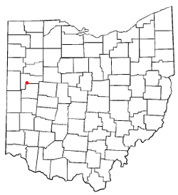
 Location of New Knoxville, Ohio |
|
 Location of New Knoxville in Auglaize County |
|
| Coordinates: 40°29′39″N 84°19′2″W / 40.49417°N 84.31722°WCoordinates: 40°29′39″N 84°19′2″W / 40.49417°N 84.31722°W | |
| Country | United States |
| State | Ohio |
| County | Auglaize |
| Township | Washington |
| Government | |
| • Mayor | Keith Leffel |
| Area | |
| • Total | 0.89 sq mi (2.31 km2) |
| • Land | 0.89 sq mi (2.31 km2) |
| • Water | 0 sq mi (0 km2) |
| Elevation | 902 ft (275 m) |
| Population (2010) | |
| • Total | 879 |
| • Estimate (2012) | 871 |
| • Density | 987.6/sq mi (381.3/km2) |
| Time zone | Eastern (EST) (UTC-5) |
| • Summer (DST) | EDT (UTC-4) |
| ZIP code | 45871 |
| Area code(s) | 419 |
| FIPS code | 39-54838 |
| GNIS feature ID | 1065123 |
| Website | http://www.newknoxville.com/ |
New Knoxville is a village in Auglaize County, Ohio, United States. It was established in 1836. The population was 879 at the 2010 census. It is included in the Wapakoneta, Ohio Micropolitan Statistical Area.
New Knoxville was platted in 1836. A post office called New Knoxville has been in operation since 1858.
New Knoxville's community historical society maintains a historical museum in the village consisting of five buildings. Three of the buildings in the "Heritage Center Complex" are listed on the National Register of Historic Places because of their place as the home and office of Dr. H.E. Fledderjohann, a leading member of the community at the turn of the twentieth century.
New Knoxville is located at 40°29′39″N 84°19′2″W / 40.49417°N 84.31722°W (40.494233, -84.317260).
According to the United States Census Bureau, the village has a total area of 0.89 square miles (2.31 km2), all land.
As of the census of 2010, there were 879 people, 355 households, and 250 families residing in the village. The population density was 987.6 inhabitants per square mile (381.3/km2). There were 382 housing units at an average density of 429.2 per square mile (165.7/km2). The racial makeup of the village was 98.6% White, 0.3% Native American, 0.3% from other races, and 0.7% from two or more races. Hispanic or Latino of any race were 1.3% of the population.
...
Wikipedia
