New Holland, Pennsylvania
| New Holland | |
|---|---|
| Borough | |

200 West Main Street
|
|
| Etymology: Holland | |
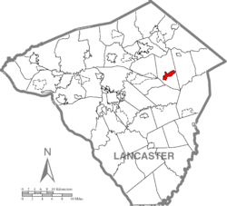
 Location of New Holland in Lancaster County |
|
| Location of New Holland in Pennsylvania | |
| Coordinates: 40°06′08″N 76°05′16″W / 40.10222°N 76.08778°WCoordinates: 40°06′08″N 76°05′16″W / 40.10222°N 76.08778°W | |
| Country | United States |
| State | Pennsylvania |
| County | Lancaster |
| Government | |
| • Mayor | Wilbur G. Horning |
| Area | |
| • Total | 2.1 sq mi (5 km2) |
| • Land | 2.1 sq mi (5 km2) |
| • Water | 0 sq mi (0 km2) |
| Elevation | 495 ft (151 m) |
| Population (2010) | |
| • Total | 5,378 |
| • Density | 2,600/sq mi (990/km2) |
| Time zone | EST (UTC-5) |
| • Summer (DST) | EDT (UTC-4) |
| ZIP code | 17557 |
| Area code(s) | 717 Exchanges: 351,354,355 |
| Website | [1] |
New Holland (Pennsylvania Dutch: Seischwamm) is a borough in Lancaster County, Pennsylvania, USA. As of the 2010 United States Census, the population was 5,378, up from 5,092 in the 2000 United States Census.
New Holland was settled in 1728 by John Michael and John Phillip Ranc (Ranck). Before it became known as New Holland, it had been called Hog Swamp, Earltown and New Design. New Holland, Pennsylvania is the twin city of Longvic, France.
The New Holland Machine Company and John Casper Stoever Log House are listed on the National Register of Historic Places.
New Holland is located at 40°6′8″N 76°5′16″W / 40.10222°N 76.08778°W (40.102095, -76.087646). According to the United States Census Bureau, the borough has a total area of 2.1 square miles (5.4 km2), all of it land.
New Holland is a terminus of the New Holland Secondary Rail Line, which splits off of the Amtrak Keystone Line just east of Lancaster Station in Lancaster, Pennsylvania. The line is owned by Norfolk Southern Railway, and is operated often to supply a number of businesses along the way, notably, RR Donnelley and Sons Printing, in Lancaster, Pennsylvania, as well as one of the Dart Container factories, and L&S Sweeteners, both in Leola, Pennsylvania.
...
Wikipedia

