Neuhausen am Rheinfall
| Neuhausen am Rheinfall | ||
|---|---|---|
 |
||
|
||
| Coordinates: 47°41′N 8°37′E / 47.683°N 8.617°ECoordinates: 47°41′N 8°37′E / 47.683°N 8.617°E | ||
| Country | Switzerland | |
| Canton | Schaffhausen | |
| District | n.a. | |
| Government | ||
| • Mayor | Stephan Rawyler FDP/PRD (as of 2008) |
|
| Area | ||
| • Total | 8.0 km2 (3.1 sq mi) | |
| Elevation | 410 m (1,350 ft) | |
| Population (Dec 2015) | ||
| • Total | 10,316 | |
| • Density | 1,300/km2 (3,300/sq mi) | |
| Postal code | 8212 | |
| SFOS number | 2937 | |
| Surrounded by | Beringen, Flurlingen (ZH), Guntmadingen, Jestetten (DE-BW), Laufen-Uhwiesen (ZH), Schaffhausen | |
| Website |
www Profile (German), SFSO statistics |
|
Neuhausen am Rheinfall (which was called Neuhausen until 1938) is a municipality in the canton of Schaffhausen in Switzerland.
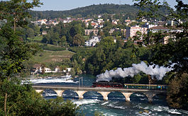
The little town is well known for the Rhine Falls, a tourist attraction and mainland Europe's largest waterfall.
Neuhausen am Rheinfall is first mentioned in 900/910 as Niuhusen. In 1253 it was mentioned as Niuwenhusin.
The German blazon reads: In gelb über grünem Kleeblatt weisses nach rechts gekehrtes Rebmesser mit braunem Griff.
The municipality’s arms might in English heraldic language be described thus: Or in base a cloverleaf couped proper above which a billhook argent hafted proper.
In 1569, Neuhausen bore arms with a gold field and a leaping silver salmon. This symbolized the importance of fishing to the municipality. Shortly thereafter, the arms appeared with different tinctures; the field was now red. With the lessening importance of fishing, the arms, too, presumably ended up being forgotten, for in 1822, arms appeared bearing the current charges, the cloverleaf and the billhook. These two charges illustrate nothing extraordinary and likely stem from the sealmaker’s lack of imagination, for he also chose the same charges for many other municipalities in the Schaffhausen area.
When the coat of arms was revised in 1949, the municipal council and the community association chose the historical arms, as there was a firm basis for them and they were unique for Schaffhausen. Shortly after this decision, though, a referendum was held in which the more modern arms won out.
Neuhausen am Rheinfall has an area, as of 2006[update], of 8.1 km2 (3.1 sq mi). Of this area, 14.5% is used for agricultural purposes, while 51.3% is forested. Of the rest of the land, 30.9% is settled (buildings or roads) and the remainder (3.2%) is non-productive (rivers or lakes).
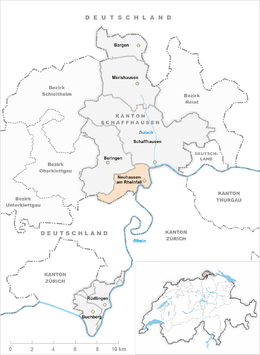
The municipality is located in the Schaffhausen district. It used to bey a haufendorf village (an irregular, unplanned and quite closely packed village, built around a central square) on the south foot of the Randen range near the Rhine Falls. Today it is an industrial city. It is located on the south-west border of the city of Schaffhausen. Until 1938 Neuhausen am Rheinfall was known as Neuhausen.
...
Wikipedia


