Needles, CA
| Needles, California | |
|---|---|
| Charter city | |

City sign
|
|
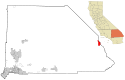
 Location in San Bernardino County and the state of California |
|
| Coordinates: 34°50′53″N 114°36′51″W / 34.84806°N 114.61417°WCoordinates: 34°50′53″N 114°36′51″W / 34.84806°N 114.61417°W | |
| Country | |
| State |
|
| County |
|
| Incorporated | October 30, 1913 |
| Area | |
| • Total | 31.275 sq mi (81.002 km2) |
| • Land | 30.808 sq mi (79.793 km2) |
| • Water | 0.467 sq mi (1.209 km2) 1.49% |
| Elevation | 495 ft (151 m) |
| Population (2010) | |
| • Total | 4,844 |
| • Density | 150/sq mi (60/km2) |
| Time zone | Pacific (UTC−8) |
| • Summer (DST) | PDT (UTC−7) |
| ZIP code | 92363 |
| Area codes | 442/760 |
| FIPS code | 06-50734 |
| GNIS feature IDs | 1652757, 2411220 |
| Website | www |
Needles (Mojave: ʼAha Kuloh) is a city in San Bernardino County, California, United States. It lies on the western banks of the Colorado River in the Mohave Valley subregion of the Mojave Desert, near the borders of Arizona and Nevada and roughly 110 miles (180 km) from the Las Vegas Strip. It is also the easternmost city of the Greater Los Angeles area. The city is accessible via Interstate 40 and U.S. Route 95. The population was 4,844 at the 2010 census, up from 4,830 at the 2000 census.
Needles was named after "The Needles", a group of pinnacles, mountain peaks in the Mohave Mountains on the Arizona side of the river to the south of the city. The large Mohave Native American community shares the nearby Fort Mojave Indian Reservation and the town. Needles is a gateway to the Mojave National Preserve.
"Ancient petroglyphs, pictographs, intaglios art, and old trails and stonework sites, bear witness to those who came from an earlier time."
...
Wikipedia
