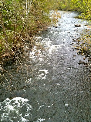
Naugatuck River
| Naugatuck River (Neggutuck) | |
| Great River, Nawcatuck | |
| River | |
|
Naugatuck River in Oakville from Whitestone Cliffs Trail road walk over Frost Bridge - CT Route 262
|
|
| Country | United States |
|---|---|
| State | Connecticut |
| Region | Litchfield County and New Haven County |
| Tributaries | |
| - left | East Branch Naugatuck River, Leadmine Brook, Spruce Brook, Hancock Brook, Mad River, Hockanum Brook, Bladens River |
| - right | West Branch Naugatuck River, Northfield Brook, Branch Brook, Steele Brook, Hop Brook, Little River |
| Cities | Torrington, Litchfield, Harwinton, Thomaston, Watertown, Waterbury, Naugatuck, Beacon Falls, Seymour, Ansonia, Derby |
| Source | |
| - location | Confluence of West and East Branches Naugatuck River in Torrington, Connecticut |
| - elevation | 526 ft (160 m) |
| - coordinates | 41°47′49″N 073°07′00″W / 41.79694°N 73.11667°W |
| Mouth | Confluence with Housatonic River |
| - location | Derby, Connecticut |
| - elevation | 3 ft (1 m) |
| - coordinates | 41°18′49″N 073°04′50″W / 41.31361°N 73.08056°WCoordinates: 41°18′49″N 073°04′50″W / 41.31361°N 73.08056°W |
The Naugatuck River is a 40.2-mile-long (64.7 km)river in the U.S. state of Connecticut. Its waters carve out the Naugatuck River Valley in the western reaches of the state, flowing generally due south and eventually emptying into the Housatonic River at Derby, Connecticut and thence 11 miles (18 km) to Long Island Sound. The Plume and Atwood Dam in Thomaston, completed in 1960 following the Great Flood of 1955, creates a reservoir on the river and is the last barrier to salmon and trout migrating up from the sea.
Various Algonquian bands, often included in the Wappinger tribe, originally inhabited the Naugatuck River Valley. In fact, the name "Naugatuck" is derived from an Algonquian term meaning "lone tree by the fishing place". One early 19th century author explained that this name originally referred to a specific tree along the river in the area of modern-day Beacon Falls, but came to be applied broadly to the entire river over time. The valley was later settled in the 17th century by English colonists. Given its rocky soil, which was not good for farming, and the high potential for water power, the Naugatuck Valley became an industrialized area in the 19th century. It has been associated with the brass and copper industries.
After winding through rural forested areas, the two branches of the Naugatuck River enter downtown Torrington and join just north of East Albert Street at about 530 feet (160 m) above sea level. The East Branch of the Naugatuck River is 11.4 miles (18.3 km) long and originates in Winchester as a tributary of Lake Winchester at an elevation of about 1,250 feet (380 m). The West Branch, 5.9 miles (9.5 km) long, begins at the confluence of Jakes Brook, Hart and Hall Meadow brooks in the western part of Torrington, at an elevation of 800 feet (240 m).
...
Wikipedia

