Nashik District
|
Nashik district नाशिक जिल्हा |
|
|---|---|
| District of Maharashtra | |
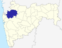
 Location of Nashik district in Maharashtra |
|
| Country | India |
| State | Maharashtra |
| Administrative division | Nashik Division |
| Headquarters | Nashik |
| Tehsils | 1. Nashik, 2. Sinnar, 3. Igatpuri, 4. Trimbak, 5. Niphad, 6. Yeola, 7. Peth, 8. Dindori, 9. Chandwad, 10. Nandgaon, 11. Surgana, 12. Kalwan, 13. Deola, 14. Baglan, 15. Malegaon |
| Government | |
| • Lok Sabha constituencies | 1. Nashik, 2. Dindori (ST), 3. Dhule (shared with Dhule district) Based on (Election Commission website) |
| Area | |
| • Total | 15,582 km2 (6,016 sq mi) |
| Population (2001) | |
| • Urban | 0% |
| Major highways | NH-3, NH-50 |
| Website | Official website |
Nashik district, also known as Nasik district, is a district in Maharashtra, India. The city of Nashik is the administrative headquarters of the district.
Nashik district is the third largest district in Maharashtra in terms of area occupying an area of 15,582 square kilometres in the [[NORTH MAHARASHTRA ]] region. It is bounded by Dhule district to the north, Jalgaon district to the east, Aurangabad district to the southeast, Ahmadnagar district to the south, Thane district to the southwest, Valsad and Navsari districts of Gujarat to the west, and The Dangs district to the northwest.
The Western Ghats or Sahyadri range stretches from north to south across the western portion of the district. With the exception of the westernmost few villages, the western portion is hilly, and intersected by ravines, and only the simplest kind of cultivation is possible. The western slope of the Ghats is drained by several rivers, including the Daman Ganga River, which drains westwards to the Arabian Sea.
The larger eastern portion of the district, which lies on the Deccan Plateau, is open, fertile, and well cultivated. The Satmala-Chandwad Range, which runs east and west, forms the chief divide of the plateau region. Peninsular India's largest river Godavari originates in the district in the Trimbakeshwar Range and continues its soujourn eastwards through the district. The Satmala-Chandwad Range forms a watershed, such that, the rivers emerging to its south drain into the Godavari. These include the Kadva and Darna both of which are tributaries of the Godavari. To the north of the Satmala-Chandwad Range, the Girna River and its tributary, the Mosam, flow eastward through fertile valleys into the Tapti River.
...
Wikipedia
