Narmada Kund
|
Amarkantaka अमरकंटक AmraKutt |
|
|---|---|
| Hill station | |

|
|
| Nickname(s): Maikal | |
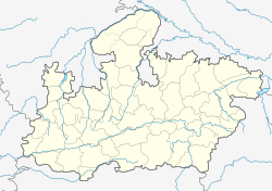
| Location in Madhya Pradesh, India | |
| Coordinates: 22°40′N 81°45′E / 22.67°N 81.75°ECoordinates: 22°40′N 81°45′E / 22.67°N 81.75°E | |
| Country |
|
| State | Madhya Pradesh |
| District | Anuppur |
| Elevation | 1,048 m (3,438 ft) |
| Population (2001) | |
| • Total | 7,074 |
| Languages | |
| • Official | Hindi |
| Time zone | IST (UTC+5:30) |
| PIN | 484886 |
| ISO 3166 code | IN-MP |
Amarkantak (NLK Amarakaṇṭaka) is a pilgrim town and a Nagar Panchayat in Anuppur, Madhya Pradesh, India. The Amarkantak region is a unique natural heritage area and is the meeting point of the Vindhya and the Satpura Ranges, with the Maikal Hills being the fulcrum. This is where the Narmada River, the Son River and Johila River emerge.
Popular 15th-century Indian mystic and poet Kabir is said to have meditated on Kabir Chabutra, also called the platform of Kabir, situated in the town of Amarkantak.
Amarkantak is a combination of two Sanskrit words, amara (immortal) and kantaka (obstruction). The poet Kalidas has mentioned it as Amrakuta, which later became Amarkantak.
Amarkantak is located in the state of Madhya Pradesh in India at 22°40′N 81°45′E / 22.67°N 81.75°E. It has an average elevation of 1048 metres (3438 ft). Roads running through Rewa, Shahdol, Anuppur, Jabalpur, Katni and Pendra connect it. The nearest railway stations are Anuppur and Pendra Road 43 km via Keonchi and only 28 km via Jwaleshwar. The nearest airport is Dumna Jabalpur (Jabalpur Airport) in the city of Jabalpur, Madhya Pradesh (240 km) which has daily flight service to Delhi and Mumbai.
...
Wikipedia


