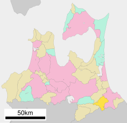
Nanbu, Aomori
|
Nanbu 南部町 |
|||
|---|---|---|---|
| Town | |||

Nanbu Town Hall
|
|||
|
|||
 Location of Nanbu in Aomori Prefecture |
|||
| Coordinates: 40°28′1″N 141°22′54″E / 40.46694°N 141.38167°ECoordinates: 40°28′1″N 141°22′54″E / 40.46694°N 141.38167°E | |||
| Country | Japan | ||
| Region | Tōhoku | ||
| Prefecture | Aomori Prefecture | ||
| District | Sannohe | ||
| Area | |||
| • Total | 151.15 km2 (58.36 sq mi) | ||
| Population (April 2012) | |||
| • Total | 19,275 | ||
| • Density | 126/km2 (330/sq mi) | ||
| Time zone | Japan Standard Time (UTC+9) | ||
| Symbols | |||
| • Tree | Japanese red pine | ||
| • Flower | Peony | ||
| • Bird | Japanese bush-warbler | ||
| Phone number | 0178-84-2111 | ||
| Address | Aomori-ken, Sannohe-gun, Nanbu-machi, Shimojuku 23-1 039-0802 |
||
| Website | Official website | ||
Nanbu (南部町 Nanbu-chō?) is a town located in Sannohe District of southeastern Aomori Prefecture in the Tōhoku region of Japan. As of April 2012, the town had an estimated population of 19,275 and a population density of 126 persons per km2. Its total area was 153.150 km2.
Nanbu occupies hilly land in the far southeast corner of Aomori Prefecture. Much of the town is mountainous, and has a cold maritime climate characterized by cool short summers and long cold winters with heavy snowfall.
During the Edo period, the area was controlled by the Nambu clan of Morioka Domain and later by Hachinohe Domain. Nambu Village was created on April 20, 1955 through the merger of former Hirasaki and Muko villages. It was elevated to town status on February 11, 1959. On January 1, 2006, Nanbu merged with Fukuchi and Nagawa into the new town of Nanbu.
The economy of Nanbu is heavily dependent on agriculture, especially horticulture. The main crops are apples, grapes and European pears.
...
Wikipedia


