Nahan
|
Nahan नाहन |
|
|---|---|
| City | |

The Fort of Nahan, the capital of princely-state of Sirmur, c. 1850
|
|
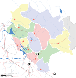
| Location in Himachal Pradesh, India | |
| Coordinates: 30°33′N 77°18′E / 30.55°N 77.3°ECoordinates: 30°33′N 77°18′E / 30.55°N 77.3°E | |
| Country |
|
| State | Himachal Pradesh |
| District | Sirmaur |
| Elevation | 932 m (3,058 ft) |
| Population (2011) | |
| • Total | 56,000 |
| • Rank | 4th in Himachal |
| Languages | |
| • Official | Hindi |
| Time zone | IST (UTC+5:30) |
Nahan is a town in Himachal Pradesh in India and is the headquarters of the Sirmaur District. It is also the location of the Indian Army Special Forces Training School. It was the capital of the former Sirmur princely state.
Nahan is located at 30°33′N 77°18′E / 30.55°N 77.3°E. It has an average elevation of 932 metres.
As of 2001[update] India census, Nahan tehsil had a population of 56053. Males constitute 54% of the population and females 46%. Nahan has an average literacy rate of 85%, higher than the national average of 59.5%: male literacy is 86%, and female literacy is 79%. In Nahan, 11% of the population is under 6 years of age. According to 2011 Census of India, Nahan has a population of 35000. The sex ratio was 916 females per thousand males and literacy rate stood at 91.4% with male literacy at 94.01% and female literacy at 88.71%.
A well-laid out picturesque town, Nahan is situated on a hill top in the Shiwalik Hills, overlooking green hills. Traditionally, saints and princes are linked with the origin of Nahan. The city was founded as in 1621 by Raja Karam Prakash.. Another version recalls a saint who lived with a companion named Nahar on the site where the Nahan palace now stands. "Nahar" means Don't kill and the town probably takes its name from an incident when a king was trying to kill a lion and the saint said Nahar, that is do not kill it. The name of the saint was Baba Banwari Das.
...
Wikipedia


