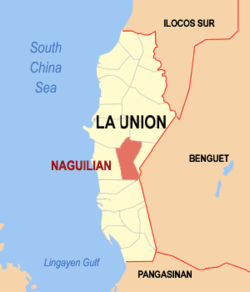
Naguilian, La Union
| Naguilian | ||
|---|---|---|
| Municipality | ||

Naguilian town center along the Naguilian Road
|
||
|
||
| Nickname(s): The True Heart of La Union | ||
 Location in the province of La Union |
||
| Location within the Philippines | ||
| Coordinates: 16°32′N 120°24′E / 16.53°N 120.4°ECoordinates: 16°32′N 120°24′E / 16.53°N 120.4°E | ||
| Country | Philippines | |
| Region | Ilocos Region (Region I) | |
| Province | La Union | |
| District | 2nd District | |
| Established | February 18, 1839 | |
| Barangays | 37 | |
| Government | ||
| • Mayor | Reynaldo Jacildo Flores | |
| Area | ||
| • Total | 104.60 km2 (40.39 sq mi) | |
| Population (2015 census) | ||
| • Total | 54,221 | |
| • Density | 520/km2 (1,300/sq mi) | |
| Time zone | PST (UTC+8) | |
| ZIP code | 2511 | |
| IDD : area code | +63 (0)72 | |
| Income class | 1st class | |
| Website | www |
|
Naguilian is a municipality in the province of La Union, Philippines. According to the 2015 census, it has a population of 54,221 people.
Naguilian is 40 kilometres (25 mi) from Baguio City via the Naguilian Road and 17 kilometres (11 mi) from the provincial capital, San Fernando.
Naguilian is characterized by hills and mountains that are gently rolling, bordered by the Cordillera Mountains in the east. The alienable lands are rolling plains in narrow strips, framed by the mountains slopes and the banks of rivers, crisscrossed by streams and springs from the side of the mountains. Its soil varies from clay loam to sandy loam and golds.
There are two major rivers in Naguilian. The Naguilian River is located in the western portion of the town. It flows westward beginning from the province of Benguet towards La Union and empties into the South China Sea, draining the valleys of Barangays Bimmotobot, Mamat-ing Sur, Mamat-ing Norte, Tuddingan, Gusing Sur, Gusing Norte, Baraoas Norte, Daramuangan, Dal-lipaoen, Cabaritan Sur, Ortiz, Natividad, Suguidan Norte and Suguidan Sur. It has a length of approximately 67 kilometres (42 mi) and has a basin area of 658 square kilometres (254 sq mi). As classified by the Environmental Management Bureau, the upper reaches of the river falls under Class A which means that it is suitable as water supply source for drinking. The lower reaches has lower water quality, categorized under Class C.
The other major stream springs from the Municipality of Burgos and drains the valleys of Barangays Aguioas, Sili, Al-alinao Norte, Nagsidorisan, Angin, Suguidan Norte and Natividad. These two rivers meet at the poblacion where it forms a delta, then meander through the center of the municipality and empty at the mouth of the river in Bauang.
The municipality’s climate falls under the first type of climate in the Philippines, characterized by two (2) distinct seasons, wet and dry. The wet season usually comes in May and ends in the early part of October. The rest of the year is dry season.
...
Wikipedia


