N7 road (Ireland)
| N7 road | |
|---|---|
| Route information | |
| Part of |
|
| Length: | 205 km (127 mi) |
| Location | |
| Primary destinations: |
(bypassed routes in italics) |
| Road network | |
| M7 motorway | |
|---|---|
| Route information | |
Part of  |
|
| Length: | 112 km (70 mi) Planned length: 185 km (115 mi) |
| History: | Opened in 1983 (Naas bypass, J7-J8) 1993 (Newbridge Bypass, J8-J10) 1997 (Portlaoise bypass) 2003 (Kildare bypass) 2004 (Monasterevin bypass) 2004 (Limerick Southern Ring Road - Phase I) 2010 (Nenagh to Limerick), (Portlaoise to Borris-in-Ossory), (Castletown to Nenagh) |
| Major junctions | |
| From: | (N7 from Dublin) Naas |
|
|
|
| To: | Rosbrien Interchange Limerick |
| Location | |
| Primary destinations: |
Naas (M9 to Waterford & Kilkenny), Newbridge, Monasterevin, Portlaoise (M8 to Cork), Roscrea, Nenagh, Limerick (M20 to Cork, Tralee & Killarney) |
| Road network | |
(bypassed routes in italics)
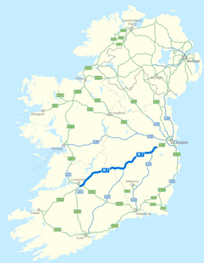
The N7 road is a national primary road in Ireland, connecting Limerick and Dublin. The majority of the route (between Naas and Limerick) is motorway standard and is designated as the M7 motorway. At the Rosbrien interchange in Limerick the route continues as the N18 dual carriage to Shannon and Ennis. The road passes through the midlands of Ireland, and acts as a trunk route out of Dublin for the N8 and N9 national primary routes to Cork and Waterford respectively. It forms part of European route E20.
From the M50, the N7 passes south of Clondalkin leaving the city as part of the Naas Road. (The Naas Road begins at the Grand Canal as a regional road (R810), a continuation of the Tyrconnell Road. It continues 3.4 km southwest to the M50 motorway, at the Red Cow interchange, where it becomes the N7.) The N7 route continues in a south west direction with 3 lanes of traffic each way towards Naas for approximately 15 km (9.3 mi). Construction of the third lane commenced on the 4 January 2005 and concluded on 14 August 2006 (thumbnail left); having been originally dualled between 1963 and 1968.
...
Wikipedia


