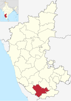
Mysuru district
| Mysuru district | |
|---|---|
| District | |

|
|
 Location in Karnataka, India |
|
| Coordinates: 12°13′N 76°29′E / 12.21°N 76.49°ECoordinates: 12°13′N 76°29′E / 12.21°N 76.49°E | |
| Country |
|
| Division | Mysore division |
| Headquarters | Mysore |
| Talukas | Mysore, Tirumakudalu Narasipura, Nanjangud, Heggadadevanakote, Hunsur, Piriyapatna, Krishnarajanagara |
| Government | |
| • Deputy Commissioner | Randeep D, IAS |
| Area | |
| • Total | 6,854 km2 (2,646 sq mi) |
| Population (2001) | |
| • Total | 3,101,027 |
| • Density | 450/km2 (1,200/sq mi) |
| Languages | |
| • Official | Kannada |
| Time zone | IST (UTC+5:30) |
| ISO 3166 code | IN-KA |
| Vehicle registration | KA-09, KA-45, KA-55 |
| Website | mysore |
Mysore District is an administrative district located in the southern part of the state of Karnataka, India. The district is bounded by Mandya district to the east and northeast, Chamrajanagar district to the southeast, Kerala state to the south, Kodagu district to the west, and Hassan district to the north. It features many tourist destinations, from Mysore Palace to Nagarhole National Park. This district has a prominent place in the history of Karnataka; Mysore was ruled by the Wodeyars from the year 1399 till the independence of India in the year 1947. Mysore's prominence can be gauged from the fact that the Karnataka state was known previously as Mysore state.
It is the third most populous district in Karnataka (out of 30), after Bangalore and Belgaum.
Mysore district gets its name from the city of Mysore which is also the headquarters of the district. The original name of this city was Mahishapura derived from a demon named Mahishasura. A statue of Mahishasura, after whom the city is named, and a temple dedicated to Goddess Chamundeshwari on the top of Chamundi Hill near Mysore city, relate to the legend of its origin.
The earliest known reference of rulers in Mysore district are the Gangas who during the rule of King Avinitha (469-529 CE), moved the capital from Kolar to Talakad on the banks of the river Kaveri in the Tirumakudalu Narasipura taluk. Talakad remained their regal capital till the end of Ganga rule in the early 11th century. Gangas ruled over a greater part of Mysore district, then known by the name of Gangavadi. In the end of the 8th century, the Rashtrakuta king Dhruva Dharavarsha defeated the Ganga king Shivamara II and wrested Gangavadi from him. Gangavadi came under the governorship of Kambarasa, the son of Dhruva Dharavarsha. Gangas who were overthrown from Gangavadi, had to wait till their king Nitimarga Ereganga (853–869 CE) won a victory against the Rashtrakutas at Rajaramudu. Seeing the increasing might of the Gangas, the Rashtrakuta King Amoghavarsha I gave his daughter Revakanimmadi in marriage to the son of Ereganga, Butuga II who became the ruler of Gangavadi. Gangas ruled over Gangavadi till the Ganga king, Rakkasa Ganga (985–1024 CE) was defeated by the Cholas.
...
Wikipedia
