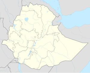
Mustahīl (town)
|
Mustahīl Mustaxiil (Somali) |
|
|---|---|
| Location in Ethiopia | |
| Coordinates: 05°06′23″N 44°45′09″E / 5.10639°N 44.75250°ECoordinates: 05°06′23″N 44°45′09″E / 5.10639°N 44.75250°E | |
| Country | Ethiopia |
| Region | Somali Region |
| Time zone | EAT (UTC+3) |
Mustahīl (Amharic: ሙስታሂል?, Somali: Mustaxiil) is a town in eastern Ethiopia, close to the border with Somalia. Located in the Gode Zone in the Somali Region and straddling the Shabelle River, it has a latitude and longitude of 5°15′N 44°44′E / 5.250°N 44.733°E with an altitude of 193 meters above sea level. It is the main town of the Mustahīl woreda.
In the early 1930s the Italians with their banda troops encroached some distance inside Ethiopian territory into the Ogaden. Colonel Rettli had his headquarters at Mustahil, where he made contact with Sultan Olol Diinle and convinced him to support the Italian cause.
Mustahil has been subjected to a number of floods of the Shabelle. In October 1961, the river rose three meters. The Ethiopian Red Cross was among organizations providing aid in that crisis. Seven years later Mustahil suffered serious flooding again (May 1968). A third occasion was in April–May 2003, when the Shabelle once again burst its banks, forcing some 96,000 people to flee their homes. Kelafo and Mustahil were amongst the hardest hit. A UNICEF representative said that the situation was "worse than any year before."
...
Wikipedia

