Municipality of Trstenik
|
Trstenik Трстеник |
|||
|---|---|---|---|
| Town and municipality | |||
 |
|||
|
|||
 Location of the municipality of Trstenik within Serbia |
|||
| Coordinates: 43°37′N 20°59′E / 43.617°N 20.983°ECoordinates: 43°37′N 20°59′E / 43.617°N 20.983°E | |||
| Country |
|
||
| Region | Šumadija and Western Serbia | ||
| District | Rasina | ||
| Settlements | 51 | ||
| Government | |||
| • Mayor | Stevan Đaković | ||
| Area | |||
| • Municipality | 448 km2 (173 sq mi) | ||
| Population (2011 census) | |||
| • Town | 15,329 | ||
| • Municipality | 42,989 | ||
| Time zone | CET (UTC+1) | ||
| • Summer (DST) | CEST (UTC+2) | ||
| Postal code | 37240 | ||
| Area code | +381 37 | ||
| Car plates | TS | ||
| Website | www |
||
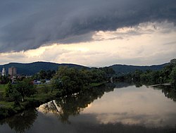
Trstenik (Serbian Cyrillic: Трстеник, pronounced [tr̩stěniːk]) is a town and municipality located in the Rasina District of the central Serbia. According to 2011 census, the population of the town is 15,329, while population of the municipality was 42,989. It lies on the West Morava. The town is known for its industry of hydraulics and pneumatics company, Prva Petoletka. There is also the small Trstenik Airport near the town.
In the Early and Middle Iron Age, the tribe of Triballi inhabited the West Morava. Romans conquered the area in the 1st century AD. Roman sites include the Stražbe castrum on the right bank of the river, as well as sites in Bučje and Donji Dubić, and others still unexplored. The Romans introduced the Vitis vinifera (Common Grape Vine) to the region, which still today is processed in Serbian wineyards (It is one of the main incomes in the municipality).
In the Middle Ages, Trstenik belonged to the West Morava oblast (province). The first written record of Trstenik is from Prince Lazar's Ravanica charter dated 1381, in which he donated Trstenik to the Ravanica monastery. The Ljubostinja monastery was built in the Morava architectural style.
In 1427, the Ottoman Empire conquered the areas of Kruševac and Trstenik. In the Western Morava valley, the Ottomans built the Grabovac fortress. After the final fall of the Serbian Despotate in 1459, Trstenik became an important Ottoman caravan stop. In an Austrian report dated 1784, Trstenik had 47 Muslim and 17 Christian houses, stone mosques, two inns and a few craft shops. At that time Trstenik was located 2 km west of the present town, near the village of Osaonica.
...
Wikipedia


