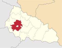
Mukacheve Raion
|
Mukacheve Raion Мукачівський район |
|||
|---|---|---|---|
| Raion | |||
|
|||
 |
|||
| Coordinates: 48°28′11.61″N 22°45′46.36″E / 48.4698917°N 22.7628778°ECoordinates: 48°28′11.61″N 22°45′46.36″E / 48.4698917°N 22.7628778°E | |||
| Country |
|
||
| Region |
|
||
| Established | 9 November 1953 | ||
| Admin. center | Mukacheve | ||
| Subdivisions |
List
|
||
| Government | |||
| • Governor | Ivan Mihailo | ||
| Area | |||
| • Total | 998 km2 (385 sq mi) | ||
| Population (2016) | |||
| • Total | 101.048 | ||
| • Density | 0.10/km2 (0.26/sq mi) | ||
| Time zone | EET (UTC+2) | ||
| • Summer (DST) | EEST (UTC+3) | ||
| Postal index | 89620—89677 | ||
| Area code | +380-3131 | ||
| Website | [1] | ||
Mukacheve Raion (Ukrainian: Мукачівський район) is a raion (district) of Zakarpattia Oblast (province) of Ukraine. Mukacheve is the administrative center of the raion. It does not belong to the raion and is incorporated separately as a city of oblast significance. Population: 101,098 (2016 est.).
There are several alternative names used for this raion: Hungarian: Munkácsi Járás, German: Rajon Mukatschewe, Russian: Мукачевский район, Slovak: Mukačivskyj rajon.
...
Wikipedia


