Mt. Pleasant, South Carolina
| Mount Pleasant, South Carolina | ||
|---|---|---|
| Suburban town | ||
| Town of Mount Pleasant | ||

Boone Hall in Mount Pleasant
|
||
|
||
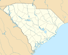
| Location of Mount Pleasant in South Carolina | ||
| Coordinates: 32°47′13″N 79°52′35″W / 32.78694°N 79.87639°WCoordinates: 32°47′13″N 79°52′35″W / 32.78694°N 79.87639°W | ||
| Country | United States | |
| State | South Carolina | |
| County | Charleston | |
| Government | ||
| • Mayor | Linda Page | |
| Area | ||
| • Total | 52.6 sq mi (136.2 km2) | |
| • Land | 45.1 sq mi (116.8 km2) | |
| • Water | 7.5 sq mi (19.5 km2) | |
| Elevation | 16 ft (5 m) | |
| Population (2010) | ||
| • Total | 67,843 | |
| • Estimate (2015) | 81,317 | |
| • Rank | US: 446th | |
| • Density | 1,505/sq mi (581.0/km2) | |
| Time zone | EST (UTC-5) | |
| • Summer (DST) | EDT (UTC-4) | |
| ZIP codes | 29464-29466 | |
| Area code | 843 | |
| FIPS code | 45-48535 | |
| GNIS feature ID | 1224770 | |
| Website | www |
|
Mount Pleasant is a large suburban town in Charleston County, South Carolina, United States. It is the fourth-largest municipality in South Carolina, and for several years it was one of the state's fastest-growing areas, doubling in population between 1990 and 2000. The population was 67,843 at the 2010 census, and the estimated population in 2014 was 77,796. It is the third-largest municipality in the Charleston – North Charleston – Summerville metropolitan area, behind Charleston and North Charleston.
At the foot of the Arthur Ravenel Bridge is Patriots Point, a naval and maritime museum, home to the World War II aircraft carrier USS Yorktown, which is now a museum ship. The Ravenel Bridge, an eight-lane highway that was completed in 2005, spans the Cooper River and links Mount Pleasant with the city of Charleston.
The site of Mount Pleasant was originally occupied by the Sewee people, an Algonquian language-speaking tribe. The first white settlers arrived from England on July 6, 1680, under the leadership of Captain Florentia O'Sullivan. Captain O'Sullivan had been granted 2,340 acres (950 ha), which included not only the island that bears his name, but also the land that was to become Mount Pleasant. On the earliest map of the time this area was called "North Point".
In 1696, 51 new settlers arrived. Each family was allotted several hundred acres in the area that became known as Christ Church parish. In 1706 the Province of Carolina withstood several attacks by the Spanish and the French from their settlements to the south and were victorious in defeating French invaders in an area known as "Abcaw".
The area of "Abcaw" was Hobcaw Plantation, located between Shem Creek and the Wando River. Later, it was also known as Shipyard Plantation because its deep water and abundance of good timber made it ideal for a prosperous shipbuilding enterprise. Lands adjacent to Hobcaw Point were owned at different times by several different families, many of which maintained ferries which served Mount Pleasant.
...
Wikipedia


