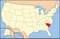
Charleston County, South Carolina
| Charleston County, South Carolina | |
|---|---|

Charleston County Courthouse
|
|
 Location in the U.S. state of South Carolina |
|
 South Carolina's location in the U.S. |
|
| Founded | 1769 |
| Seat | Charleston |
| Largest city | Charleston |
| Area | |
| • Total | 1,358 sq mi (3,517 km2) |
| • Land | 916 sq mi (2,372 km2) |
| • Water | 442 sq mi (1,145 km2), 33% |
| Population (est.) | |
| • (2015) | 389,262 |
| • Density | 382/sq mi (147/km²) |
| Congressional districts | 1st, 6th |
| Time zone | Eastern: UTC-5/-4 |
| Website | www |
Charleston County is a county located in the U.S. state of South Carolina along the Atlantic coast. As of the 2010 census, its population was 350,209, making it the third most populous county in South Carolina (behind Greenville and Richland Counties). Its county seat is Charleston. The county was created in 1901 by an act of the South Carolina State Legislature.
Charleston County is included in the Charleston-North Charleston, SC Metropolitan Statistical Area.
According to the U.S. Census Bureau, the county has a total area of 1,358 square miles (3,520 km2), of which 916 square miles (2,370 km2) is land and 442 square miles (1,140 km2) (33%) is water. It is the largest county in South Carolina by total land and water area.
As of the census of 2000, there were 309,969 people, 143,326 households, and 97,448 families residing in the county. The population density was 338 people per square mile (130/km²). There were 141,031 housing units at an average density of 154 per square mile (59/km²). The racial makeup of the county was 61.9% White, 34.5% Black or African American, 0.26% Native American, 1.12% Asian, 0.06% Pacific Islander, 0.99% from other races, and 1.16% from two or more races. 2.40% of the population were Hispanic or Latino of any race. 9.6% were of American, 9.5% English, 9.1% German and 7.6% Irish ancestry.
...
Wikipedia
