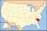
Richland County, South Carolina
| Richland County, South Carolina | |
|---|---|

The Richland County Justice Center is located across from Columbia City Hall.
|
|
 Location in the U.S. state of South Carolina |
|
 South Carolina's location in the U.S. |
|
| Founded | 1785 |
| Seat | Columbia |
| Largest city | Columbia |
| Area | |
| • Total | 772 sq mi (1,999 km2) |
| • Land | 757 sq mi (1,961 km2) |
| • Water | 15 sq mi (39 km2), 1.9% |
| Population (est.) | |
| • (2015) | 407,051 |
| • Density | 508/sq mi (196/km²) |
| Congressional districts | 2nd, 6th |
| Time zone | Eastern: UTC-5/-4 |
| Website | www |
Richland County is a county located in the U.S. state of South Carolina. As of the 2010 census, the population was 384,504, making it the second-most populous county in South Carolina, behind only Greenville County. The county seat is Columbia, the state capital.
Richland County is part of the Columbia, SC Metropolitan Statistical Area.
In 2010, the center of population of South Carolina was located in Richland County, in the city of Columbia.
Richland County was probably named for its "rich land." The county was formed in 1785 as part of the large Camden District. A small part of Richland later went to Kershaw County (1791). The county seat is Columbia, which is also the state capital. In 1786 the state legislature decided to move the capital from Charleston to a more central location. A site was chosen in Richland County, which is in the geographic center of the state, and a new town was laid out. Richland County’s boundaries were formally incorporated on Dec. 18, 1799. Cotton from the surrounding plantations was shipped through Columbia and later manufactured into textiles there. General William T. Sherman captured Columbia during the Civil War, and his troops burned the town and parts of the county on February 17, 1865. The U. S. Army returned on more friendly terms in 1917, when Fort Jackson was established, which is now the largest and most active Initial Entry Training Center in the U.S. Army.
According to the U.S. Census Bureau, the county has a total area of 772 square miles (2,000 km2), of which 757 square miles (1,960 km2) is land and 15 square miles (39 km2) (1.9%) is water. Richland County is situated in the center of South Carolina.
As of the 2010 United States Census, there were 384,504 people, 145,194 households, and 89,357 families residing in the county. The population density was 507.9 inhabitants per square mile (196.1/km2). There were 161,725 housing units at an average density of 213.6 per square mile (82.5/km2). The racial makeup of the county was 47.3% white, 45.9% black or African American, 2.2% Asian, 0.3% American Indian, 0.1% Pacific islander, 1.9% from other races, and 2.2% from two or more races. Those of Hispanic or Latino origin made up 4.8% of the population. In terms of ancestry, 9.6% were German, 8.6% were English, 7.6% were Irish, and 7.1% were American.
...
Wikipedia
