Mourão (Portugal)
| Mourão | |||
|---|---|---|---|
| Municipality | |||
|
|||
 |
|||
| Coordinates: 38°20′N 7°22′W / 38.333°N 7.367°WCoordinates: 38°20′N 7°22′W / 38.333°N 7.367°W | |||
| Country |
|
||
| Region | Alentejo | ||
| Subregion | Alentejo Central | ||
| Intermunic. comm. | Alentejo Central | ||
| District | Évora | ||
| Parishes | 3 | ||
| Government | |||
| • President | José Lopes (PS) | ||
| Area | |||
| • Total | 278.63 km2 (107.58 sq mi) | ||
| Population (2011) | |||
| • Total | 2,663 | ||
| • Density | 9.6/km2 (25/sq mi) | ||
| Time zone | WET/WEST (UTC+0/+1) | ||
| Website | http://www.cm-mourao.pt | ||
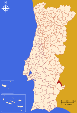
Mourão (Portuguese pronunciation: [mowˈɾɐ̃w]) is a municipality in the District of Évora in Portugal. The population in 2011 was 2,663, in an area of 278.63 km².
The municipality borders the municipality of Alandroal to the north, Spain to the west, Barrancos to the south-east, Moura to the south and Reguengos de Monsaraz to the east.
The town has the well-preserved Castle of Mourão.
The present Mayor is António José Manuel Santinha Lopes, elected by the Socialist Party. The municipal holiday is February 2.
Administratively, the municipality is divided into 3 civil parishes (freguesias):
...
Wikipedia


