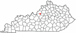
Mount Washington, Kentucky
| Mount Washington, Kentucky | |
|---|---|
| City | |
 Location of Mount Washington, Kentucky |
|
| Coordinates: 38°2′46″N 85°33′17″W / 38.04611°N 85.55472°WCoordinates: 38°2′46″N 85°33′17″W / 38.04611°N 85.55472°W | |
| Country | United States |
| State | Kentucky |
| County | Bullitt |
| Established | 1822 |
| Incorporated | 1833 |
| Reincorporated | 1954 |
| Area | |
| • Total | 6.1 sq mi (15.8 km2) |
| • Land | 6.1 sq mi (15.7 km2) |
| • Water | 0.04 sq mi (0.1 km2) |
| Elevation | 705 ft (215 m) |
| Population (2010) | |
| • Total | 9,117 |
| • Density | 1,500/sq mi (579.0/km2) |
| Time zone | Eastern (EST) (UTC-5) |
| • Summer (DST) | EDT (UTC-4) |
| ZIP code | 40047 |
| Area code(s) | 502 |
| FIPS code | 21-54228 |
| GNIS feature ID | 0498905 |
| Website | www |
Mount Washington is a home rule-class city in northeast Bullitt County, Kentucky, in the United States. The population was 9,117 at the 2010 census. The city is one of several surrounding Louisville that have experienced a sharp rise in population in the past three decades, becoming a commuter town.
Mount Washington is located at what was once the crossroads of two stagecoach routes and was originally known as The Cross Roads. It was formally established in 1822 as Mount Vernon, after President George Washington's Virginia home, but it was unable to continue using the name because another town's post office had priority. At the time, the settlement housed c. 700 people and boasted three churches, two schools, six stores and groceries, five doctors, two taverns, and twelve mechanical trades. At the time of its (first) formal incorporation as a city in 1833, the town's name was changed to "Mount Washington", again in honor of the first United States president.
Mount Washington became the economic center of Bullitt County by the 1850s. In the autumn of 1862, during the Civil War, the town was held by John Wharton's Confederate cavalry, who skirmished with Maj. Gen. Thomas L. Crittenden's men north of Mount Washington along Floyds Fork on October 1. A defeat the following day led to a Confederate retreat from the area.
Through the nineteenth century, a two-room school building stood on the southern end of Bardstown Road (now Highway 31E), but in 1916 a new building consisting of four classrooms was built. Where the four-room classroom building once stood, now stands Mt. Washington Middle School. This building was constructed in the early 1940s as the high school. Mt. Washington Middle School had to expand and remodel in 1995 because the population was growing tremendously, and now supports over 200 classrooms and offices. Since then, another middle school had to be built on the other side of the city. That project was completed in 2006.
...
Wikipedia
