Mount Pleasant Township, Westmoreland County, Pennsylvania
| Mount Pleasant Township, Westmoreland County, Pennsylvania |
|
|---|---|
| Township | |

Sewickley Manor (1852)
National Register of Historic Places |
|
 Map of Westmoreland County, Pennsylvania Highlighting Mount Pleasnt Township |
|
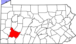
 Map of Pennsylvania highlighting Westmoreland County |
|
| Country | United States |
| State | Pennsylvania |
| County | Westmoreland |
| Settled | 1770 |
| Area | |
| • Total | 55.9 sq mi (145 km2) |
| • Land | 55.8 sq mi (145 km2) |
| • Water | 0.1 sq mi (0.3 km2) |
| Population (2000) | |
| • Total | 11,153 |
| • Density | 55.8/sq mi (21.5/km2) |
| Time zone | Eastern (EST) (UTC-5) |
| • Summer (DST) | EDT (UTC-4) |
| Website | http://www.mtpleasanttwp.com |
Mount Pleasant Township is a township in Westmoreland County, Pennsylvania, United States. As of the 2000 census, the township population was 11,153. Mount Pleasant Township should not be confused with the Borough of Mount Pleasant, which is a separate municipality and comprises the town of that name.
The Adam Fisher Homestead and Sewickley Manor are listed on the National Register of Historic Places.
The Jacob's Creek Bridge, the first iron-chain suspension bridge built in the United States, was erected at the southwest corner of the township in 1801. It was demolished in 1833, but the area is still called "Iron Bridge."
According to the United States Census Bureau, the township has a total area of 55.9 square miles (144.8 km2), of which 55.8 square miles (144.5 km2) is land and 0.2 square miles (0.5 km2) (0.30%) is water.
The township includes the following communities: Bridgeport, Brinkerton, Calumet, Carpentertown, Hecla, Kecksburg, Mammoth, Mellingertown, Mt. Joy, Norvelt, Rodney, Southwest, Standard, Trauger, United, and Weltytown.
As of the census of 2000, there were 11,153 people, 4,385 households, and 3,266 families residing in the township. The population density was 200.0 people per square mile (77.2/km²). There were 4,668 housing units at an average density of 83.7/sq mi (32.3/km²). The racial makeup of the township was 99.20% White, 0.25% African American, 0.01% Native American, 0.04% Asian, 0.01% Pacific Islander, 0.10% from other races, and 0.39% from two or more races. Hispanic or Latino of any race were 0.39% of the population.
...
Wikipedia
